Latitude: 54.0467 / 54°2'48"N
Longitude: -2.8996 / 2°53'58"W
OS Eastings: 341193
OS Northings: 461564
OS Grid: SD411615
Mapcode National: GBR 8P6N.14
Mapcode Global: WH845.FKG3
Plus Code: 9C6V24W2+M5
Entry Name: Carr Garth
Listing Date: 29 December 1950
Grade: II
Source: Historic England
Source ID: 1207205
English Heritage Legacy ID: 391806
ID on this website: 101207205
Location: Lower Heysham, Lancaster, Lancashire, LA3
County: Lancashire
District: Lancaster
Electoral Ward/Division: Heysham Central
Parish: Non Civil Parish
Built-Up Area: Heysham
Traditional County: Lancashire
Lieutenancy Area (Ceremonial County): Lancashire
Church of England Parish: Heysham St Peter
Church of England Diocese: Blackburn
Tagged with: Architectural structure
MORECAMBE AND HEYSHAM
SD4161 BAILEY LANE, Heysham 939-1/7/5 No.18 29/12/50 Carr Garth
GV II
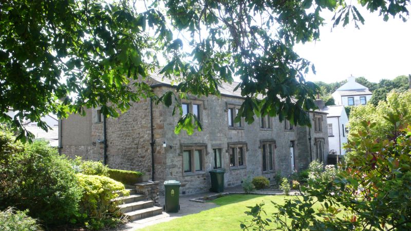
House, now used as guesthouse. Mid-to-late C19 with C17 remains. Sandstone rubble with slate roof. 2 storeys. 5 bays. Windows are of 2 lights with chamfered surrounds, central mullions, and hood moulds, all with rock-faced rustication. Windows are C20 timber casements except for those to bays 3, 4, and 5 on the 1st floor, which have original C19 iron lattice casements. Roof line continues forwards over 5th bay, which projects. Ground-floor windows to 3rd and 5th bays are taller, with lower sills. An additional ground-floor window between the 1st and 2nd bays has plain reveals and is set within a blocked quoined door opening. The present door, in the 4th bay, has a tall chamfered surround which appears to incorporate re-dressed C17 stones. In the 3rd bay on the ground floor there are the remains of a door jamb and the springing of an arch to the left of the window. To the right is a blocked mullioned window surround at a lower level. Chimneys on gables and to right of 2nd bay. At the rear there is a parallel range and a projecting wing.
Listing NGR: SD4119361564
External links are from the relevant listing authority and, where applicable, Wikidata. Wikidata IDs may be related buildings as well as this specific building. If you want to add or update a link, you will need to do so by editing the Wikidata entry.


Other nearby listed buildings