Latitude: 51.1934 / 51°11'36"N
Longitude: -3.4689 / 3°28'8"W
OS Eastings: 297449
OS Northings: 144828
OS Grid: SS974448
Mapcode National: GBR LJ.550G
Mapcode Global: VH5K4.T8GF
Plus Code: 9C3R5GVJ+9C
Entry Name: Staunton Cottage
Listing Date: 4 July 1952
Grade: II
Source: Historic England
Source ID: 1207002
English Heritage Legacy ID: 391234
ID on this website: 101207002
Location: Alcombe, Somerset, TA24
County: Somerset
District: Somerset West and Taunton
Civil Parish: Minehead
Built-Up Area: Minehead
Traditional County: Somerset
Lieutenancy Area (Ceremonial County): Somerset
Tagged with: Cottage Thatched cottage
MINEHEAD
SS9744 STAUNTON LANE, Alcombe 900-1/5/148 (West side) 04/07/52 Staunton Cottage
II
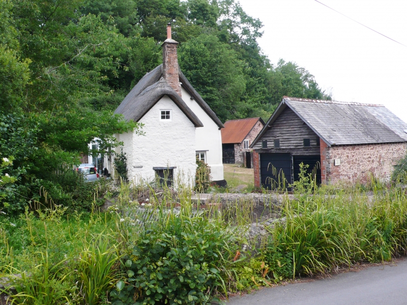
Formerly known as: Lower Staunton STAUNTON LANE Alcombe. Cottage, at a right-angle to the lane. C16 or early C17, altered and extended in C18. Cob on rubblestone, thatched roof hipped to left, gabled to right, with snecked rubblestone stack (formerly external) to former right gable end. Thatched rubblestone left-hand wing. 2-unit plan with C18 lower 2-storey wing to the left. 2 storeys; 1-window range. Timber lintels over late C19 windows and doors, the entrance to the return of the C18 wing, a former wash-house, facing the lane. The room above has access from inside the cottage. INTERIOR: 3 stop-chamfered cross-beams and oak lintel to open fire to the ground-floor right, now blocked. C19 stairs. The roof is plastered but one truss and 2 windbraces of probable C16 structure are exposed.
Listing NGR: SS9744944828
External links are from the relevant listing authority and, where applicable, Wikidata. Wikidata IDs may be related buildings as well as this specific building. If you want to add or update a link, you will need to do so by editing the Wikidata entry.


Other nearby listed buildings