Latitude: 51.2089 / 51°12'31"N
Longitude: -3.4797 / 3°28'46"W
OS Eastings: 296733
OS Northings: 146556
OS Grid: SS967465
Mapcode National: GBR LJ.429D
Mapcode Global: VH5JY.MWS5
Plus Code: 9C3R6G5C+G4
Entry Name: Holnicote
Listing Date: 4 July 1952
Grade: II
Source: Historic England
Source ID: 1206974
English Heritage Legacy ID: 391158
ID on this website: 101206974
Location: Higher Town, Somerset, TA24
County: Somerset
District: Somerset West and Taunton
Civil Parish: Minehead
Built-Up Area: Minehead
Traditional County: Somerset
Lieutenancy Area (Ceremonial County): Somerset
Tagged with: Building Thatched cottage
MINEHEAD
SS9646 CHURCH STREET 900-1/3/24 (East side) 04/07/52 No.2 Holnicote
GV II
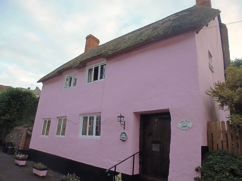
Cottage. Probably late C17. Cob and rubblestone, thatched roof with brick stacks to gable ends. 2-unit plan with gable-end stacks and entry against stack to right. 2 storeys; 2-window range. 2- and 3-light leaded casement windows, those to the first floor (at eaves level) and to the left of the door have ovolo-moulded mullions; 2 similar but later windows to the ground-floor left. The C18 halved wide-planked door to the right with wrought-iron hinges is in a C17 moulded frame with double moulded stops. C19 and C20 windows to the left return; a small leaded window to the first floor of the right return; C20 rear outshut. A small window has been inserted to view the bread oven in the right return. INTERIOR: an internal stack to a concealed open fire, with bread oven, to the right gable end; newel stair to the left. One axial beam to the ground floor. The first floor has exposed massive main rafters and trenched purlins to the 3-bay roof.
Listing NGR: SS9673346556
External links are from the relevant listing authority and, where applicable, Wikidata. Wikidata IDs may be related buildings as well as this specific building. If you want to add or update a link, you will need to do so by editing the Wikidata entry.


Other nearby listed buildings