Latitude: 53.2595 / 53°15'34"N
Longitude: -2.1194 / 2°7'9"W
OS Eastings: 392132
OS Northings: 373619
OS Grid: SJ921736
Mapcode National: GBR FZMR.Y8
Mapcode Global: WHBBP.FB0J
Plus Code: 9C5V7V5J+R6
Entry Name: Fence House
Listing Date: 17 March 1977
Grade: II
Source: Historic England
Source ID: 1206888
English Heritage Legacy ID: 390924
ID on this website: 101206888
Location: Macclesfield, Cheshire East, Cheshire, SK10
County: Cheshire East
Civil Parish: Macclesfield
Built-Up Area: Macclesfield
Traditional County: Cheshire
Lieutenancy Area (Ceremonial County): Cheshire
Church of England Parish: Macclesfield St Paul
Church of England Diocese: Chester
Tagged with: House
MACCLESFIELD
SJ9273 BUXTON ROAD 886-1/7/24 (South side) 17/03/77 Fence House
GV II
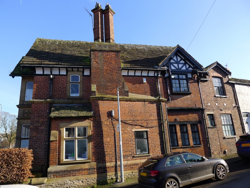
House, now in use as offices. Dated 1872. Brick with half-timbering, stone dressings and stone-flagged roof. Tudor style. 2-storeyed, asymmetrical plan with projecting gabled range to the right and lower wing set back to the left. Full-height square bay window with gabled head against gable facing street, with 4-light stone mullioned and transomed windows with strapwork decoration between the storeys. In the return, a Shaw-style oriel window carried on brackets forms a porch over the doorway. 2-light mullioned and transomed window on each floor alongside. Wing beyond has 2 mullioned windows with 4 round-headed lights forming a continuous band to first floor and a single 2-light mullioned and transomed window to ground floor. 3-light mullioned window in gable.
Listing NGR: SJ9213273619
External links are from the relevant listing authority and, where applicable, Wikidata. Wikidata IDs may be related buildings as well as this specific building. If you want to add or update a link, you will need to do so by editing the Wikidata entry.


Other nearby listed buildings