Latitude: 52.0565 / 52°3'23"N
Longitude: -2.718 / 2°43'4"W
OS Eastings: 350863
OS Northings: 240034
OS Grid: SO508400
Mapcode National: GBR FL.DLD4
Mapcode Global: VH85N.TKYV
Plus Code: 9C4V374J+JQ
Entry Name: All Saints Chambers
Listing Date: 22 October 1973
Grade: II
Source: Historic England
Source ID: 1206661
English Heritage Legacy ID: 372341
ID on this website: 101206661
Location: Hereford, County of Herefordshire, HR4
County: County of Herefordshire
Civil Parish: Hereford
Built-Up Area: Hereford
Traditional County: Herefordshire
Lieutenancy Area (Ceremonial County): Herefordshire
Church of England Parish: Hereford All Saints
Church of England Diocese: Hereford
Tagged with: Building
HEREFORD
SO5040SE EIGN GATE 683-1/6/161 (North side) 22/10/73 Nos.2, 4 AND 6 and All Saints Chambers
GV II
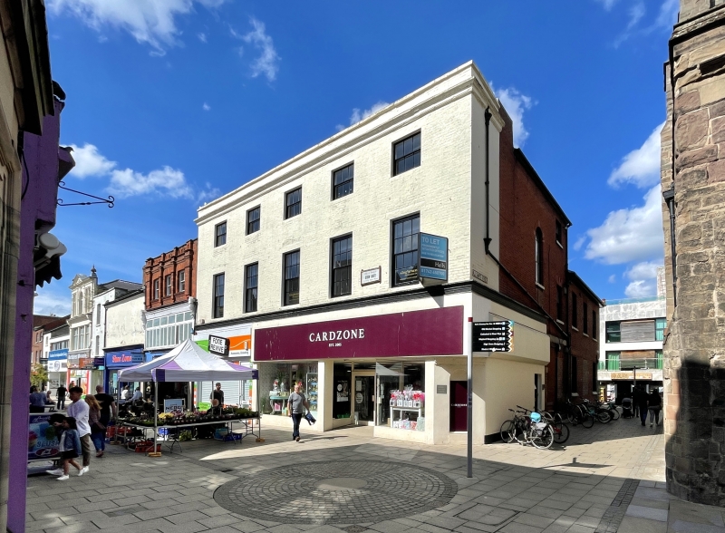
Formerly known as: The Greyhound Inn EIGN GATE. Houses, now shops and offices. Late C18. Painted brick; slate(?) roof; brick end stacks (partly demolished) to right and to rear. 3 storeys; 5-window range: two 6/6 and three 6/4 sashes of various dates, with stone sills and lintels. Five 3/3 sashes, under moulded stone cornice to brick parapet with stone canopy. Right returned side has central doorway, with partly blocked opening above, containing round-headed window with coloured margin-glazing, under gauged brick arch. INTERIOR: C20 stick baluster stairs to 1st floor; early C19 dogleg staircase with stick balusters and swan neck rail to 2nd floor. 2nd floor: C18 fire surrounds; six C18, two-panel doors, with architraves; C18 wall cupboard; C20 part-glazed door. 1st floor: five C19 part-glazed doors; 4-panel door, with architrave; window architraves and panelled risers. Cellar: ribbed springers; arched stringers; chamfered fireplace with corbelled lintel; chamfered-arch recesses; pointed-arch recess; the cellar is thought to be a C13 undercroft probably connected with All Saints' Church (qv). (RCHME).
Listing NGR: SO5086340034
External links are from the relevant listing authority and, where applicable, Wikidata. Wikidata IDs may be related buildings as well as this specific building. If you want to add or update a link, you will need to do so by editing the Wikidata entry.


Other nearby listed buildings