Latitude: 51.4685 / 51°28'6"N
Longitude: -2.5816 / 2°34'53"W
OS Eastings: 359698
OS Northings: 174552
OS Grid: ST596745
Mapcode National: GBR CCD.2F
Mapcode Global: VH88N.6CL3
Plus Code: 9C3VFC99+99
Entry Name: 55, Cobourg Road
Listing Date: 30 December 1994
Grade: II
Source: Historic England
Source ID: 1206291
English Heritage Legacy ID: 379290
ID on this website: 101206291
Location: Montpelier, Bristol, BS6
County: City of Bristol
Electoral Ward/Division: Ashley
Parish: Non Civil Parish
Built-Up Area: Bristol
Traditional County: Gloucestershire
Lieutenancy Area (Ceremonial County): Bristol
Church of England Parish: Bristol St Paul's
Church of England Diocese: Bristol
Tagged with: Building
BRISTOL
ST5974 COBOURG ROAD, Montpelier 901-1/36/1580 (South side) No.55
GV II
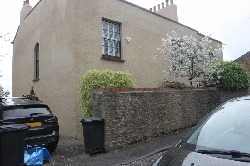
House. Early C19. Roughcast with limestone dressings and a pantile valley roof. Double-depth plan. 2 storeys and basement; 3-window range. A semicircular-arched doorway in left-hand return, below a 6/6-pane stair window; main elevation to rear has first-floor plat band, and 6/6-pane sashes to front and back. INTERIOR not inspected.
Listing NGR: ST5969874552
External links are from the relevant listing authority and, where applicable, Wikidata. Wikidata IDs may be related buildings as well as this specific building. If you want to add or update a link, you will need to do so by editing the Wikidata entry.


Other nearby listed buildings