Latitude: 51.6184 / 51°37'6"N
Longitude: 0.3036 / 0°18'12"E
OS Eastings: 559574
OS Northings: 193577
OS Grid: TQ595935
Mapcode National: GBR XN.P74
Mapcode Global: VHHN3.6LV6
Plus Code: 9F32J893+9C
Entry Name: 4-24, Coptfold Road
Listing Date: 9 December 1994
Grade: II
Source: Historic England
Source ID: 1206043
English Heritage Legacy ID: 373402
ID on this website: 101206043
Location: Brentwood, Essex, CM14
County: Essex
District: Brentwood
Electoral Ward/Division: Brentwood South
Parish: Non Civil Parish
Built-Up Area: Brentwood
Traditional County: Essex
Lieutenancy Area (Ceremonial County): Essex
Church of England Parish: Brentwood St Thomas
Church of England Diocese: Chelmsford
Tagged with: Building
BRENTWOOD
TQ5993 COPTFOLD ROAD 723-1/12/60 (East side) Nos.4-24 (Even)
GV II
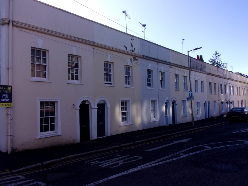
Row of 11 terraced houses. Early C19. Stuccoed front, ashlar lined, slate roofs. 2 storey. Each house has L-plan with rear, ground-floor service block, paired side by side. N front elevation, whole now with continuous parapet and moulded cornice. Each house has ground-floor doorway with semicircular fanlight and moulded stucco architrave. Single ground-floor window with similar moulded architrave and sashes with glazing bars, 3x4 panes. On first floor, 2 windows with projecting stucco keystones, plain surround to sashes with glazing bars, 3x4 panes. Houses paired with adjacent front doors and chimney-stacks in the other party wall. A number of the windows still retain hinged slots for partial opening of the upper sash. All front doors appear to be replaced at various times and some fanlights are now blocked.
Listing NGR: TQ5957493577
External links are from the relevant listing authority and, where applicable, Wikidata. Wikidata IDs may be related buildings as well as this specific building. If you want to add or update a link, you will need to do so by editing the Wikidata entry.


Other nearby listed buildings