Latitude: 51.7194 / 51°43'9"N
Longitude: -1.9771 / 1°58'37"W
OS Eastings: 401681
OS Northings: 202292
OS Grid: SP016022
Mapcode National: GBR 2PL.4ZH
Mapcode Global: VHB2Q.P15S
Plus Code: 9C3WP29F+P5
Entry Name: Dovecote at Barton House
Listing Date: 23 July 1971
Grade: II
Source: Historic England
Source ID: 1204879
English Heritage Legacy ID: 365136
ID on this website: 101204879
Location: Cirencester, Cotswold, Gloucestershire, GL7
County: Gloucestershire
District: Cotswold
Civil Parish: Cirencester
Built-Up Area: Cirencester
Traditional County: Gloucestershire
Lieutenancy Area (Ceremonial County): Gloucestershire
Church of England Parish: Cirencester St John the Baptist
Church of England Diocese: Gloucester
Tagged with: Dovecote
CIRENCESTER
SP0102 THE BARTON 578-1/3/385 Dovecote at Barton House 23/07/71
GV II
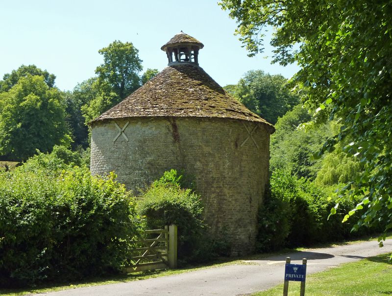
Dovecote. Late C17 or C18. Coursed squared limestone rubble; stone slate roof. Circular building approximately 4m in diameter. C19/C20 plank door with exposed timber lintel; glover at apex of roof has two tiers of openings and circular stone-slated roof with simple C19 wrought-iron weather vane. INTERIOR has nesting boxes in walls around approximately 2/3 of circumference; central post with revolving ladder; 8-bay roof structure with butt-purlins probably early C19, two of four collars and struts probably later strengthening; joinery of glover probably C19 or C20. Two iron tie bars cross below collars.
Listing NGR: SP0168102292
External links are from the relevant listing authority and, where applicable, Wikidata. Wikidata IDs may be related buildings as well as this specific building. If you want to add or update a link, you will need to do so by editing the Wikidata entry.


Other nearby listed buildings