Latitude: 51.2874 / 51°17'14"N
Longitude: 0.2867 / 0°17'11"E
OS Eastings: 559552
OS Northings: 156739
OS Grid: TQ595567
Mapcode National: GBR XH.QY8
Mapcode Global: VHHPM.XWDX
Plus Code: 9F3277PP+XM
Entry Name: Old Forge House
Listing Date: 1 August 1952
Last Amended: 3 May 1984
Grade: II*
Source: Historic England
Source ID: 1204195
English Heritage Legacy ID: 357283
ID on this website: 101204195
Location: Ightham, Tonbridge and Malling, Kent, TN15
County: Kent
District: Tonbridge and Malling
Civil Parish: Ightham
Built-Up Area: Ightham
Traditional County: Kent
Lieutenancy Area (Ceremonial County): Kent
Church of England Parish: Ightham St Peter
Church of England Diocese: Rochester
Tagged with: House
TQ 5956 IGHTHAM THE STREET 5/12 (south-east side)
1.8.52 Old Forge House (formerly listed under Main Road) GV II*
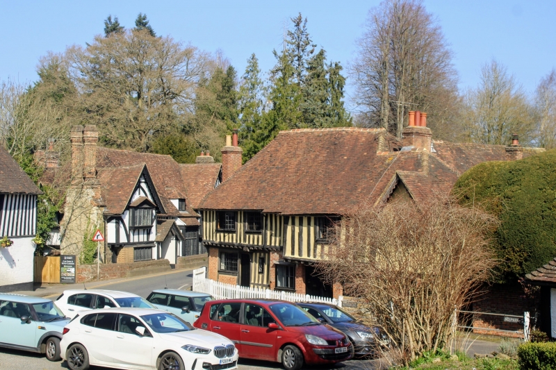
Remains of C16 hall-house dated 1555 to left, C19 additions to right. Red brick and random stone exposed vertical timber-framing with plaster infilling above. First floor jetty supported on exposed joists and brackets, continuous, though at lower level to right. Small C19 addition to right, coursed rubble stone with red brick dressings on ground floor, rendered first floor; return gable to front. Two storeys; 4 window front, very irregular, all C19 casement windows. Two boarded doors to right of centre, one to left. Projecting weatherboarded wing to rear. The house is one of the earliest continuous jetty houses in Kent, in 1555 Thomas Skynner was fired for building encroaching the highway.
Listing NGR: TQ5955256739
External links are from the relevant listing authority and, where applicable, Wikidata. Wikidata IDs may be related buildings as well as this specific building. If you want to add or update a link, you will need to do so by editing the Wikidata entry.


Other nearby listed buildings