Latitude: 51.2676 / 51°16'3"N
Longitude: 1.3066 / 1°18'23"E
OS Eastings: 630759
OS Northings: 157249
OS Grid: TR307572
Mapcode National: GBR X17.F4S
Mapcode Global: VHLGR.LDLK
Plus Code: 9F337894+3J
Entry Name: Parsonage Farmhouse
Listing Date: 11 October 1963
Grade: II
Source: Historic England
Source ID: 1203872
English Heritage Legacy ID: 178416
ID on this website: 101203872
Location: Marshborough, Dover, Kent, CT13
County: Kent
District: Dover
Civil Parish: Woodnesborough
Traditional County: Kent
Lieutenancy Area (Ceremonial County): Kent
Tagged with: Farmhouse
TR 35 NW WOODNESBOROUGH MARSHBOROUGH
6/384 Parsonage 11.l0.53 Farmhouse
GV II
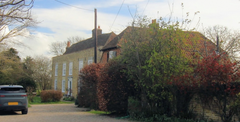
House. C17 or earlier, refronted late C18. Timber framed and clad with buff brick, with red brick in English bond to side and rear elevations and tile hung left return. Plain tiled roof. Two storeys and parapet to hipped roof with stacks to centre right and offset and projecting at end left. Four glazing bar sashes and 1 window space on first floor and 4 glazing bar sasnes with cambered heads on ground floor. Central door of 6 raised and fielded panels with cornice an pilasters and 3 steps. Interior: panelled entrance hall with moulded joists. Late C17 panelled room with several fitted cupboards. The house is adjacent to and partly in a moated site.
Listing NGR: TR3075957249
External links are from the relevant listing authority and, where applicable, Wikidata. Wikidata IDs may be related buildings as well as this specific building. If you want to add or update a link, you will need to do so by editing the Wikidata entry.


Other nearby listed buildings