Latitude: 51.0722 / 51°4'20"N
Longitude: 0.696 / 0°41'45"E
OS Eastings: 588971
OS Northings: 133782
OS Grid: TQ889337
Mapcode National: GBR QW3.NST
Mapcode Global: FRA D6B9.4YV
Plus Code: 9F323MCW+VC
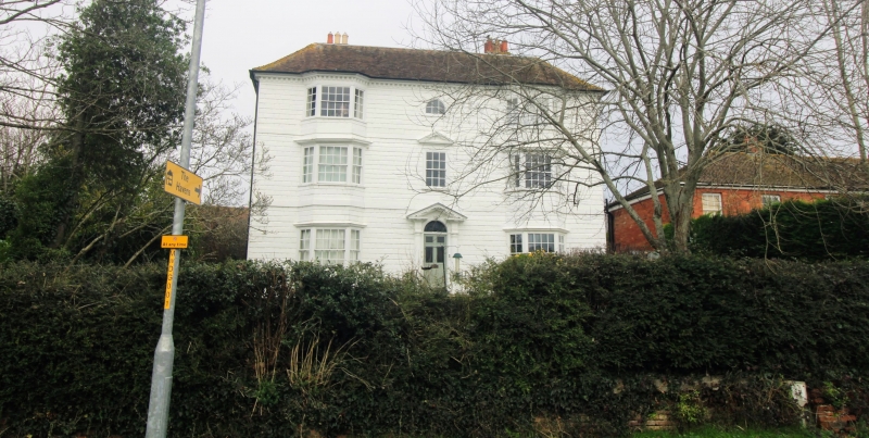
Entry Name: Craythorne
Listing Date: 8 May 1950
Grade: II
Source: Historic England
Source ID: 1203630
English Heritage Legacy ID: 179846
ID on this website: 101203630
Location: Tenterden, Ashford, Kent, TN30
County: Kent
District: Ashford
Civil Parish: Tenterden
Built-Up Area: Tenterden
Traditional County: Kent
Lieutenancy Area (Ceremonial County): Kent
Tagged with: Building
1. 1715 WOODCHURCH ROAD (North West Side)
Craythorne TQ 8833 1/132 8.5.50.
II
2. Late C18, 3 storeys. Stuccoed and grooved in imitation of masonry. Ripped roof and bracket eaves cornice. Stringcourse above ground and 1st floors. 2 bay windows on all floors. Between the bays a doorcase up 5 steps with fluted Doric columns, open pediment and semi-circular fanlight. The centre 1st floor window above the doorcase has a pediment over it. Above this window there is a rusticated lunette window with glazing bars intact.
Listing NGR: TQ8897133782
External links are from the relevant listing authority and, where applicable, Wikidata. Wikidata IDs may be related buildings as well as this specific building. If you want to add or update a link, you will need to do so by editing the Wikidata entry.


Other nearby listed buildings