Latitude: 52.3687 / 52°22'7"N
Longitude: -2.7204 / 2°43'13"W
OS Eastings: 351048
OS Northings: 274765
OS Grid: SO510747
Mapcode National: GBR BK.RYT4
Mapcode Global: VH843.SQQH
Plus Code: 9C4V979H+FR
Entry Name: 1-5, Upper Linney
Listing Date: 9 August 1993
Grade: II
Source: Historic England
Source ID: 1202936
English Heritage Legacy ID: 390120
ID on this website: 101202936
Location: Ludlow, Shropshire, SY8
County: Shropshire
Civil Parish: Ludlow
Built-Up Area: Ludlow
Traditional County: Shropshire
Lieutenancy Area (Ceremonial County): Shropshire
Church of England Parish: Ludlow St Laurence
Church of England Diocese: Hereford
Tagged with: Building
LUDLOW
SO5174 UPPER LINNEY 825-1/1/484 (North side) Nos.1-5 (Consecutive)
GV II
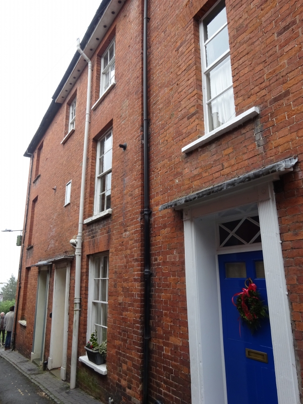
Houses. Early C19. Brick; hipped slate roof with 3 ridge levels; 4 cross-axial, 1 square, ridge stacks. 5-unit terrace plan. 3-storeys and basements; 7-window range, with tiers (3 blocked) of 6/6 sashes to ground and 1st floors, and 3/6 sashes to 2nd floors; one tier of staircase lights to No.3, under segmental arches. Panelled doors with overlights, and flat hoods on reeded pilasters. Left returned side has 2 tiers of sashes. Rear: 5 tiers, one blocked to right, of 8/8 sashes, with 4/8 sashes to top floors, under gauged brick flat arches, and to No.5, stone lintels; No.2 has C20 canted bow to ground floor; various doors and fenestration to basements.
Listing NGR: SO5105374767
External links are from the relevant listing authority and, where applicable, Wikidata. Wikidata IDs may be related buildings as well as this specific building. If you want to add or update a link, you will need to do so by editing the Wikidata entry.


Other nearby listed buildings