Latitude: 52.3662 / 52°21'58"N
Longitude: -2.7204 / 2°43'13"W
OS Eastings: 351045
OS Northings: 274482
OS Grid: SO510744
Mapcode National: GBR BK.S4YV
Mapcode Global: VH843.SSPF
Plus Code: 9C4V978H+FR
Entry Name: 9, Mill Street
Listing Date: 15 April 1954
Grade: II
Source: Historic England
Source ID: 1202900
English Heritage Legacy ID: 390018
ID on this website: 101202900
Location: Ludlow, Shropshire, SY8
County: Shropshire
Civil Parish: Ludlow
Built-Up Area: Ludlow
Traditional County: Shropshire
Lieutenancy Area (Ceremonial County): Shropshire
Church of England Parish: Ludlow St Laurence
Church of England Diocese: Hereford
Tagged with: Building
LUDLOW
SO5174 MILL STREET 825-1/1/383 (East side) 15/04/54 No.9
GV II
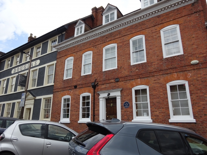
House. C18. Brick; plain tile roof; brick stack to rear. Central staircase plan. Symmetrical 2-storeys, attic and cellar; 5-window range: early C20, 4/4 sashes in moulded cases under gauged brick segmental arches; storey band; moulded and modillioned wood eaves; 3 gable dormers with 2-light casements and moulded pediments. Steps to central 6-panel door, with moulded flat hood on pilasters with capitals; flanked by similar sashes under deeper gauged brick segmental arches; storey band. Right gable shows brick front keyed into rubble wall, with brick corner stack to rear. Twin gabled rear range largely of rubble, with 6/6 sashes and 2-light casement, under brick segmental arches; small fixed light, and C20 casement under concrete lintel. INTERIOR: C18 panelled room to ground floor right.
Listing NGR: SO5104774482
External links are from the relevant listing authority and, where applicable, Wikidata. Wikidata IDs may be related buildings as well as this specific building. If you want to add or update a link, you will need to do so by editing the Wikidata entry.


Other nearby listed buildings