Latitude: 52.369 / 52°22'8"N
Longitude: -2.7178 / 2°43'3"W
OS Eastings: 351227
OS Northings: 274789
OS Grid: SO512747
Mapcode National: GBR BK.RZKB
Mapcode Global: VH843.VQ39
Plus Code: 9C4V979J+HV
Entry Name: 19, Bull Ring
Listing Date: 15 March 1974
Grade: II
Source: Historic England
Source ID: 1202816
English Heritage Legacy ID: 389795
ID on this website: 101202816
LUDLOW
SO5174 BULL RING 825-1/1/169 (East side) 15/03/74 No.19
GV II
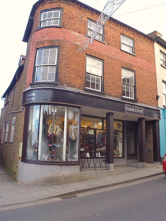
House, now shop and dwelling. Late C18 to earlier core. Brick; plain tile roof, curved hip to left; brick stack to rear. 3-storeys; 3-window range: late C18, 6/6 sashes (the left being bowed) in moulded cases, under gauged brick flat arches; painted band; 3/3 sashes over, as below; brick modillion eaves. C20 shopfront, with cast-iron pillars to left. Left gable shows that brick facade is fronting rubble core. Gable has C17 brick quoins to rear, above rubble wing, which has an early C18, 6/6 sash in beaded moulded case under timber lintel, and three C20 lights to ground floor, one in reduced opening under timber lintel. Rear of wing has brick upper structure, suggesting probable raising C18, and has C19 brick flue inserted; rubble gable with steep pitch roof of C18 plain tiles, and C20 casement; C20 flat roofed addition to left upper floor. Further wing has tiled roof to right, Welsh slate roof to left and C20 composites to gable end. Site of Corve Gate.
Listing NGR: SO5122774789
External links are from the relevant listing authority and, where applicable, Wikidata. Wikidata IDs may be related buildings as well as this specific building. If you want to add or update a link, you will need to do so by editing the Wikidata entry.


Other nearby listed buildings