Latitude: 52.3662 / 52°21'58"N
Longitude: -2.7186 / 2°43'6"W
OS Eastings: 351166
OS Northings: 274482
OS Grid: SO511744
Mapcode National: GBR BK.S5D9
Mapcode Global: VH843.TSNF
Plus Code: 9C4V978J+FH
Entry Name: 46, 47 and 48, Broad Street
Listing Date: 28 October 1969
Grade: II
Source: Historic England
Source ID: 1202809
English Heritage Legacy ID: 389769
ID on this website: 101202809
LUDLOW
SO5174 BROAD STREET 825-1/1/145 (West side) 28/10/69 Nos.46, 47 AND 48
GV II
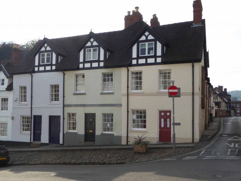
Houses. C18 front to earlier core. Roughcast; plain tile roof with hipped gable to rear wing; brick end stack to right, and brick stack to rear; 3-unit terrace. 2-storeys and attic; 6-window range: 6/6 sashes. 3 large dormers with 2-light casements with leaded light uppers, in fake timber-framing. To left, central 6-panel door flanked by late C19, 8/8 sash and plank door to passage; central unit has similar entrance, flanked by 6/6 sashes; right-hand unit has similar door now with glazed panels, and late C19, 8/8 sash to left. Stucco storey band; C15 stone figurehead corbel to far left. Left return: C19 brick gable, with moulded barge boards; right return: rendered gable with 3, C19 lights, base of buttressed rubble stack.
Listing NGR: SO5116874479
External links are from the relevant listing authority and, where applicable, Wikidata. Wikidata IDs may be related buildings as well as this specific building. If you want to add or update a link, you will need to do so by editing the Wikidata entry.


Other nearby listed buildings