Latitude: 51.4698 / 51°28'11"N
Longitude: -2.5836 / 2°35'0"W
OS Eastings: 359558
OS Northings: 174694
OS Grid: ST595746
Mapcode National: GBR CBC.MZ
Mapcode Global: VH88N.5BH4
Plus Code: 9C3VFC98+WH
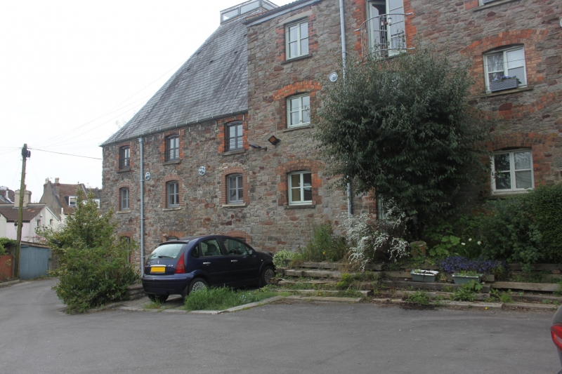
Entry Name: The Malthouse
Listing Date: 6 June 1975
Last Amended: 30 December 1994
Grade: II
Source: Historic England
Source ID: 1202518
English Heritage Legacy ID: 380397
ID on this website: 101202518
Location: Montpelier, Bristol, BS6
County: City of Bristol
Electoral Ward/Division: Ashley
Parish: Non Civil Parish
Built-Up Area: Bristol
Traditional County: Gloucestershire
Lieutenancy Area (Ceremonial County): Bristol
Church of England Parish: Bishopston and St Andrews
Church of England Diocese: Bristol
Tagged with: Architectural structure
BRISTOL
ST5974 ST ANDREW'S ROAD, Montpelier 901-1/36/1600 (South East side) 06/06/75 No.142 The Malthouse (Formerly Listed as: ST ANDREW'S ROAD No.142 The Maltings)
II
Maltings. Early C19. Pennant rubble with brick dressings, pantile hipped roof and slate pyramidal roof to oast house. Open plan rectangular malthouse and attached square oast house. Maltings of 3 storeys; 11-window range, with 2-storey; 3-window range oast house. Small segmental-headed windows, with relieving arches below on the W side, to windows with inserted jambs; 2 projecting hoist covers above doors to the E eaves, and to the N end above the widened C20 opening. INTERIOR: ground- and first-floor cast-iron columns with Romanesque capitals and round flanges bearing heavy floor beams, C20 timber roof, but few functional details; the oast house has first floor of perforated clay tiles, related to malting process.
Listing NGR: ST5955874694
External links are from the relevant listing authority and, where applicable, Wikidata. Wikidata IDs may be related buildings as well as this specific building. If you want to add or update a link, you will need to do so by editing the Wikidata entry.


Other nearby listed buildings