Latitude: 52.5875 / 52°35'15"N
Longitude: -2.1444 / 2°8'39"W
OS Eastings: 390313
OS Northings: 298869
OS Grid: SO903988
Mapcode National: GBR 18J.RT
Mapcode Global: WHBFZ.1745
Plus Code: 9C4VHVQ4+26
Entry Name: Cleveland Place
Listing Date: 3 February 1977
Grade: II
Source: Historic England
Source ID: 1201878
English Heritage Legacy ID: 378589
ID on this website: 101201878
Location: Whitmore Reans, Wolverhampton, West Midlands, WV1
County: City of Wolverhampton
Electoral Ward/Division: Park
Parish: Non Civil Parish
Built-Up Area: Wolverhampton
Traditional County: Staffordshire
Lieutenancy Area (Ceremonial County): West Midlands
Church of England Parish: Central Wolverhampton
Church of England Diocese: Lichfield
Tagged with: Building
WOLVERHAMPTON
SO99NW TETTENHALL ROAD 895-1/5/329 (North side) 03/02/77 Nos.26-32 (Even) Cleveland Place
GV II
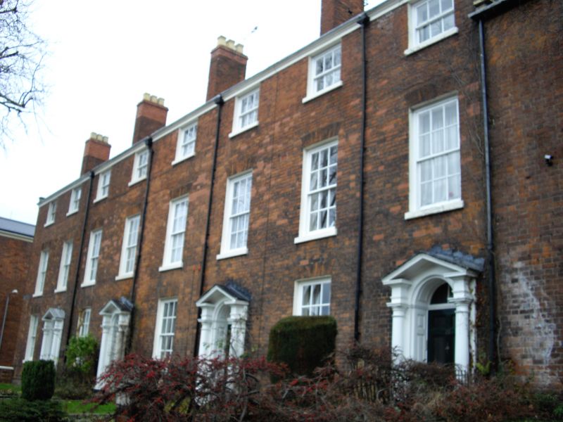
Terrace of 4 houses. Late C18. Brick with stone dressings and slate roof with coped ends with brick stacks. Double-depth plan. 3 storeys; 8-window range, 2 bays to each house. Windows to ground and 1st floors have rubbed brick flat arches over 12-pane sashes; 2nd floor has 6-pane sashes. Round-headed entrances to 2nd, 4th, 6th and 8th bays have Doric aedicules with open pediments, 6-panel doors. No 28 has stained glass fanlight; Nos 30 and 32 have fanlights with decorative glazing bars. Gable-end stacks and cross-axial stacks paired across ridge. Attached stone-coped front garden walls. Stone plaque with name: CLEVELAND PLACE to left hand end. INTERIOR of No 32 has stick-baluster staircase.
Listing NGR: SO9031398869
External links are from the relevant listing authority and, where applicable, Wikidata. Wikidata IDs may be related buildings as well as this specific building. If you want to add or update a link, you will need to do so by editing the Wikidata entry.


Other nearby listed buildings