Latitude: 53.3908 / 53°23'26"N
Longitude: -3.0459 / 3°2'45"W
OS Eastings: 330540
OS Northings: 388729
OS Grid: SJ305887
Mapcode National: GBR 7Y57.C6
Mapcode Global: WH87D.51TC
Plus Code: 9C5R9XR3+8J
Entry Name: Canonhill (Flats)
Listing Date: 10 August 1992
Grade: II
Source: Historic England
Source ID: 1201565
English Heritage Legacy ID: 389278
ID on this website: 101201565
Location: Claughton, Wirral, Merseyside, CH43
County: Wirral
Electoral Ward/Division: Claughton
Parish: Non Civil Parish
Built-Up Area: Birkenhead
Traditional County: Cheshire
Lieutenancy Area (Ceremonial County): Merseyside
Church of England Parish: Birkenhead Christ the King
Church of England Diocese: Chester
Tagged with: Architectural structure Terrace of houses
BIRKENHEAD
SJ3088 PARK ROAD SOUTH 789-1/10/129 Nos.1-24 (Consecutive) Canonhill (flats)
II
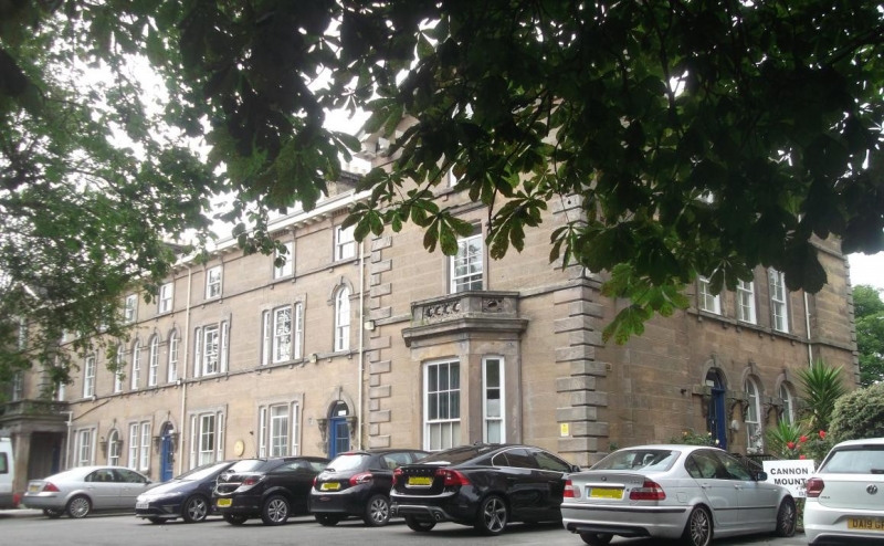
Terrace of houses now subdivided as flats. c1860. Ashlar faced with renewed tiled roof. Italianate style. 3 storeys, loosely symmetrical overall with projecting pedimented outer bays, but asymmetrical central range to street of 7 bays with irregular fenestration. Advanced outer bays have angle quoins and canted bay window with pierced parapet to ground floor with 8-pane sash above and round-arched window in pediment. Central range comprised 5 units, with doorways flanked by alternately tripartite and paired sash windows, now all renewed in original openings. Round-arched architraves to doorways and upper windows. Rear elevation to park a symmetrical composition with outer pedimented gabled bays, and squared bay windows alternating with renewed sash windows across the central section. Large ridge stacks with bracketted caps.
Listing NGR: SJ3054088728
External links are from the relevant listing authority and, where applicable, Wikidata. Wikidata IDs may be related buildings as well as this specific building. If you want to add or update a link, you will need to do so by editing the Wikidata entry.


Other nearby listed buildings