Latitude: 50.265 / 50°15'53"N
Longitude: -5.0512 / 5°3'4"W
OS Eastings: 182643
OS Northings: 45011
OS Grid: SW826450
Mapcode National: GBR ZF.XGC4
Mapcode Global: FRA 089B.9ZN
Plus Code: 9C2P7W7X+XG
Entry Name: 1-9, Union Place
Listing Date: 19 June 1973
Grade: II
Source: Historic England
Source ID: 1201541
English Heritage Legacy ID: 377610
ID on this website: 101201541
Location: Truro, Cornwall, TR1
County: Cornwall
Civil Parish: Truro
Built-Up Area: Truro
Traditional County: Cornwall
Lieutenancy Area (Ceremonial County): Cornwall
Church of England Parish: St Mary Truro
Church of England Diocese: Truro
Tagged with: Building
TRURO
SE8245SE UNION PLACE 880-1/4/300 (South East side) 19/06/73 Nos.1-9 (Consecutive)
GV II
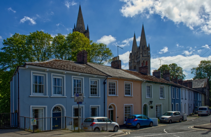
Row of 9 small town houses. Early C19. Stucco fronts; natural slate roof to No.2, otherwise asbestos slate, all with projecting eaves on wooden brackets, hipped end to No.1 (left), brick end stacks. Double-depth-plan row of similar houses with 1 room at the front and entrance hall on the left, except No.1 which has small rooms left of hall. 2 storeys; overall 20-window range of 2-window fronts except No.1 which has 4 windows. Round-arched doorways with fanlights (plain except for No.1 which is spoked) over panelled doors; stucco architraves to Nos 1-4 otherwise plain openings with keyblocks; original sashes with glazing bars, margin panes to ground-floor sashes and to first-floor left of No.1. INTERIORS: where inspected retain original carpentry, joinery and plasterwork with moulded and carved ceiling cornices and bands.
Listing NGR: SW8266645022
External links are from the relevant listing authority and, where applicable, Wikidata. Wikidata IDs may be related buildings as well as this specific building. If you want to add or update a link, you will need to do so by editing the Wikidata entry.


Other nearby listed buildings