Latitude: 51.9974 / 51°59'50"N
Longitude: -2.1562 / 2°9'22"W
OS Eastings: 389371
OS Northings: 233231
OS Grid: SO893332
Mapcode National: GBR 1JK.MPQ
Mapcode Global: VH93T.K2Y3
Plus Code: 9C3VXRWV+XG
Entry Name: King John's Bridge
Listing Date: 4 March 1952
Grade: II*
Source: Historic England
Source ID: 1201287
English Heritage Legacy ID: 376890
ID on this website: 101201287
Location: Tewkesbury, Gloucestershire, GL20
County: Gloucestershire
District: Tewkesbury
Civil Parish: Tewkesbury
Built-Up Area: Tewkesbury
Traditional County: Gloucestershire
Lieutenancy Area (Ceremonial County): Gloucestershire
Church of England Parish: Tewkesbury St Mary the Virgin (Tewkesbury Abbey)
Church of England Diocese: Gloucester
Tagged with: Bridge
TEWKESBURY
SO8933 MYTHE ROAD 859-1/5/313 King John's Bridge 04/03/52
GV II*
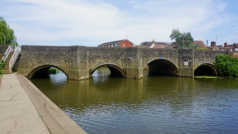
Road bridge over River Mill Avon. Originally built c1190, but frequently repaired or rebuilt, including substantial remedial works in 1747, 1783, and 1810, culminating in major restructuring in 1824. General reconstruction completed in 1962. Coursed sandstone ashlar. 5 low segmental arches in 2 square recessed orders, a fifth arch, near E end higher than others, to triangular cutwaters with refuges each side. Heavy weathered coping. Abutments continue to W for approx 27m, and on N side is a plaque giving historical information, including long quotation from Leland (1769) concerning King John's involvement in the earlier bridge. The low arches are carried on series of heavy square ribs for about two-thirds of the road width, and some of the masonry on the upstream side appears to have survived the 1962 rebuild. On the downstream side, to the W, a set of 14 steps leads down to the riverside walk, breaking cleanly through the parapet. (Victoria County History: Gloucestershire: London: 1968-: 114-5).
Listing NGR: SO8937133231
External links are from the relevant listing authority and, where applicable, Wikidata. Wikidata IDs may be related buildings as well as this specific building. If you want to add or update a link, you will need to do so by editing the Wikidata entry.


Other nearby listed buildings