Latitude: 50.3562 / 50°21'22"N
Longitude: -4.4559 / 4°27'21"W
OS Eastings: 225395
OS Northings: 53584
OS Grid: SX253535
Mapcode National: GBR NG.VTH4
Mapcode Global: FRA 18K3.7VG
Plus Code: 9C2Q9G4V+FJ
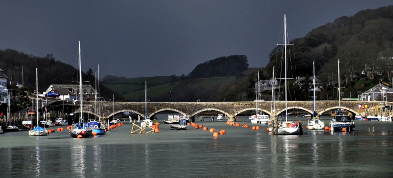
Entry Name: Bridge over East Looe River and Lamp Standards
Listing Date: 8 November 1993
Grade: II
Source: Historic England
Source ID: 1201093
English Heritage Legacy ID: 376357
Also known as: Looe Bridge
ID on this website: 101201093
Location: Looe, Cornwall, PL13
County: Cornwall
Civil Parish: Looe
Built-Up Area: Looe
Traditional County: Cornwall
Lieutenancy Area (Ceremonial County): Cornwall
Church of England Parish: St Martin with St Nicholas, Looe
Church of England Diocese: Truro
Tagged with: Road bridge
LOOE
SX2453 EAST LOOE 857-1/4/1 Bridge over East Looe River and Lamp Standards
GV II
Includes: Bridge over East Looe River and lamp standards West Looe. Road bridge over river. 1853 replacing narrow medieval bridge of 15 arches. Slatestone rubble with granite dressings. Straight bridge with 7 bays of segmental arches over river, a similar dry arch at the East Looe end and a narrow roud-arched curved pedestrian passage at the West Looe end. Cutwaters both up and down stream for tidal river. Segmental parapet copings with parapet as quadrant-on-plan return to terminal pier to East Looe corner, otherwise straight ends with similar piers. Subsidiary features: 6 cast-iron lamp standards with turned bases, fluted shafts and cross bars, 3 surmounting each parapet. Included for historical and group value.
Listing NGR: SX2539553584
External links are from the relevant listing authority and, where applicable, Wikidata. Wikidata IDs may be related buildings as well as this specific building. If you want to add or update a link, you will need to do so by editing the Wikidata entry.


Other nearby listed buildings