Latitude: 51.4314 / 51°25'52"N
Longitude: -1.5374 / 1°32'14"W
OS Eastings: 432256
OS Northings: 170363
OS Grid: SU322703
Mapcode National: GBR 6ZZ.84F
Mapcode Global: VHC1S.99L2
Plus Code: 9C3WCFJ7+G2
Entry Name: Chilton Cottage
Listing Date: 6 March 1985
Grade: II
Source: Historic England
Source ID: 1200682
English Heritage Legacy ID: 310591
ID on this website: 101200682
Location: Chilton Foliat, Wiltshire, RG17
County: Wiltshire
Civil Parish: Chilton Foliat
Built-Up Area: Chilton Foliat
Traditional County: Wiltshire
Lieutenancy Area (Ceremonial County): Wiltshire
Tagged with: Cottage Thatched cottage
SU 37 SW CHILTON FOLIAT A.419 (north side)
5/128 Nos 88, 89 and 90 Chilton Cottage
II
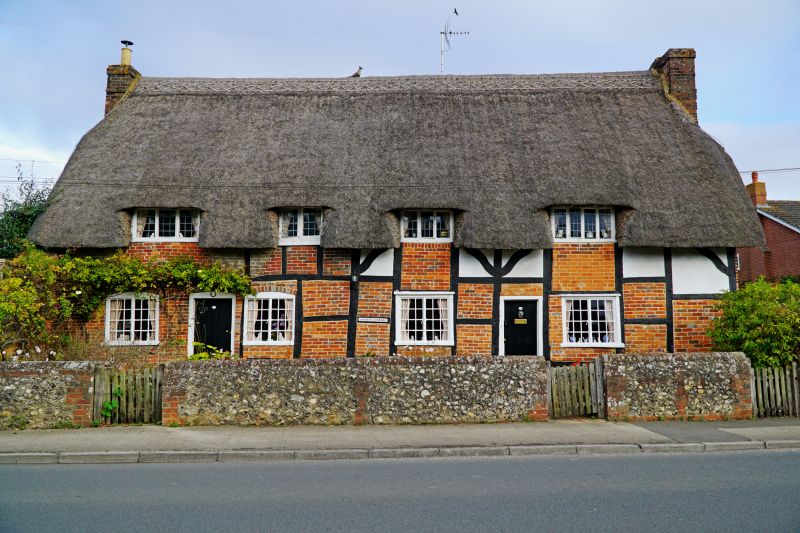
3 Cottages, now house, early-mid C15, restored 1975-7. Timber framed on flint sill, brick and plaster infill. Thatched roof. 1 storey and attic. 5 bays, the right 2 bays originally an open hall with inserted right gable stack, originally timber framed, and bay to left a parlour, later a bootmakers workshop, also with later inserted stack. 2 left bays with cross binder, a later extension with gable stack and oven. Rear lean-to full length. Boarded doors in 1st and 4th bays and iron casement windows with segmental brick heads to ground floor; 2-and 3-light leaded windows to 4 flush dormers. Thatch swept down over rear lean-to. Dates established by C-14 with dendrochronological correction on post of frame and wattle and daub. Thatch also dated by C-14 to 1580-1670. Reference: Report in Wilts Buildings Records Library.
Listing NGR: SU3225670363
External links are from the relevant listing authority and, where applicable, Wikidata. Wikidata IDs may be related buildings as well as this specific building. If you want to add or update a link, you will need to do so by editing the Wikidata entry.


Other nearby listed buildings