Latitude: 51.5978 / 51°35'52"N
Longitude: -1.3389 / 1°20'20"W
OS Eastings: 445884
OS Northings: 188977
OS Grid: SU458889
Mapcode National: GBR 7ZF.Y00
Mapcode Global: VHCYK.R30G
Plus Code: 9C3WHMX6+4C
Entry Name: Cob Wall Approximately 15 North West of the Plough Public House
Listing Date: 9 February 1976
Last Amended: 25 March 1988
Grade: II
Source: Historic England
Source ID: 1200070
English Heritage Legacy ID: 250147
ID on this website: 101200070
Location: East Hendred, Vale of White Horse, Oxfordshire, OX12
County: Oxfordshire
District: Vale of White Horse
Civil Parish: East Hendred
Built-Up Area: East Hendred
Traditional County: Berkshire
Lieutenancy Area (Ceremonial County): Oxfordshire
Tagged with: Wall
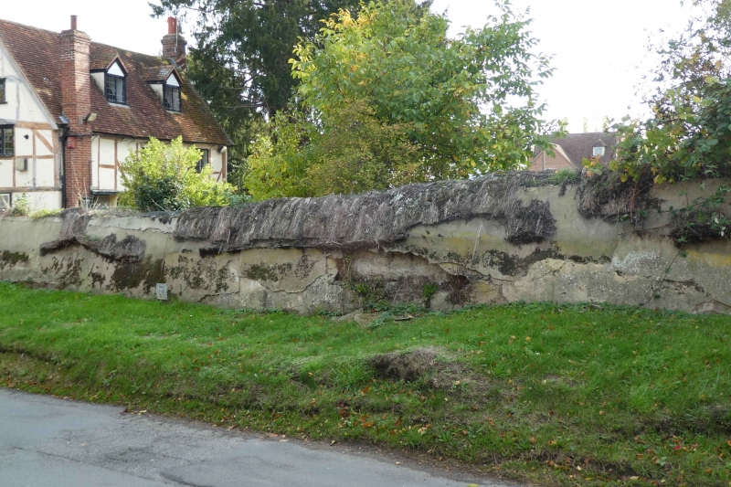
EAST HENDRED ORCHARD LANE SU4588 (South side) 19/109 Cob wall approx. 15m. NW of 09/02/76 The Plough Public House Formerly listed as Cob wall to road running eastwards from Star Cottage)
GV II Wall. Probably C18. Cob, with thatch coping. Approx. 1 1/2 metres high and 12 metres long.
Listing NGR: SU4588488977
External links are from the relevant listing authority and, where applicable, Wikidata. Wikidata IDs may be related buildings as well as this specific building. If you want to add or update a link, you will need to do so by editing the Wikidata entry.


Other nearby listed buildings