Latitude: 51.5889 / 51°35'19"N
Longitude: -1.5767 / 1°34'35"W
OS Eastings: 429425
OS Northings: 187865
OS Grid: SU294878
Mapcode National: GBR 5WN.B68
Mapcode Global: VHC0Z.MBB9
Plus Code: 9C3WHCQF+H8
Entry Name: Merestones
Listing Date: 21 November 1966
Grade: II
Source: Historic England
Source ID: 1199178
English Heritage Legacy ID: 250820
ID on this website: 101199178
Location: Woolstone, Vale of White Horse, Oxfordshire, SN7
County: Oxfordshire
District: Vale of White Horse
Civil Parish: Woolstone
Traditional County: Berkshire
Lieutenancy Area (Ceremonial County): Oxfordshire
Church of England Parish: Woolstone
Church of England Diocese: Oxford
Tagged with: Building
WOOLSTONE WOOLSTONE ROAD SU28NE 5/181 Merestones 21/11/66
GV II
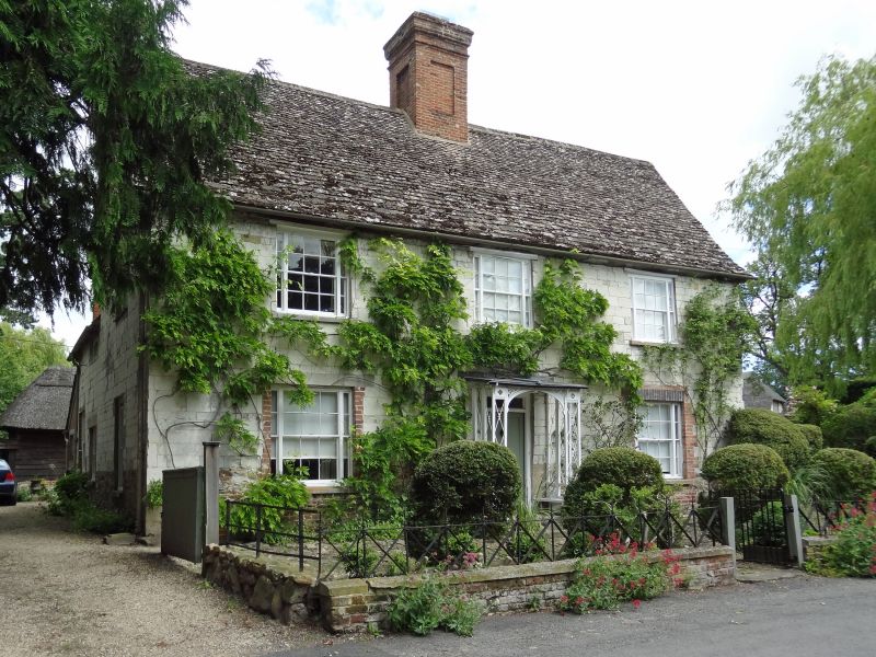
House. c.1700, extended in mid C18 and mid C19. Chalk ashlar on sarsen base; stone slate roof; brick stacks. U-plan with 2-unit front range. 2 storey, 3- window range. Mid C19 trellised porch to mid C19 4-panelled door with over light. Mid C19 sashes with margin lights have timber lintels over 1st floor, original chalk lintel and mid C19 brick soldier arch over ground floor. Gabled roof; fine central stack has central recessed panel and moulded detail to top; Interior: Chalk lintel and timber lintel to original fireplaces; mid C19 dado to central through passage and mid C19 4-panelled doors; stone flag floor to rear left; mid C19 stairs, to rear right: dog-leg with landing, closed-string square newels with carved detail and turned finials; original plank and panelled doors with strap hinges at 1st and attic floor levels; the two attic doors have timber frames with chamfered and stopped frames; original common rafter-roof with butt purlins. To rear left is C18 stepped chalk stack (blocks original window) adjoining brick and tile mid C19 lean-to. Mid C19 brick and tile lean-to at rear filling in original yard. Mid C18 one-bay block to rear right in Flemish bond brick, and uncoursed chalk rubble; tile(j Mid Cl? wing to front right has been demolished.
Listing NGR: SU2942787868
External links are from the relevant listing authority and, where applicable, Wikidata. Wikidata IDs may be related buildings as well as this specific building. If you want to add or update a link, you will need to do so by editing the Wikidata entry.


Other nearby listed buildings