Latitude: 51.1034 / 51°6'12"N
Longitude: -2.3261 / 2°19'33"W
OS Eastings: 377266
OS Northings: 133838
OS Grid: ST772338
Mapcode National: GBR 0TV.LS0
Mapcode Global: VH97Z.MJNH
Plus Code: 9C3V4M3F+9H
Entry Name: Rockwork Bridge
Listing Date: 6 January 1966
Last Amended: 9 September 1987
Grade: I
Source: Historic England
Source ID: 1199172
English Heritage Legacy ID: 321252
ID on this website: 101199172
Location: Bonham, Wiltshire, BA12
County: Wiltshire
Civil Parish: Stourton with Gasper
Traditional County: Somerset
Lieutenancy Area (Ceremonial County): Wiltshire
Church of England Parish: Upper Stour
Church of England Diocese: Salisbury
Tagged with: Footbridge
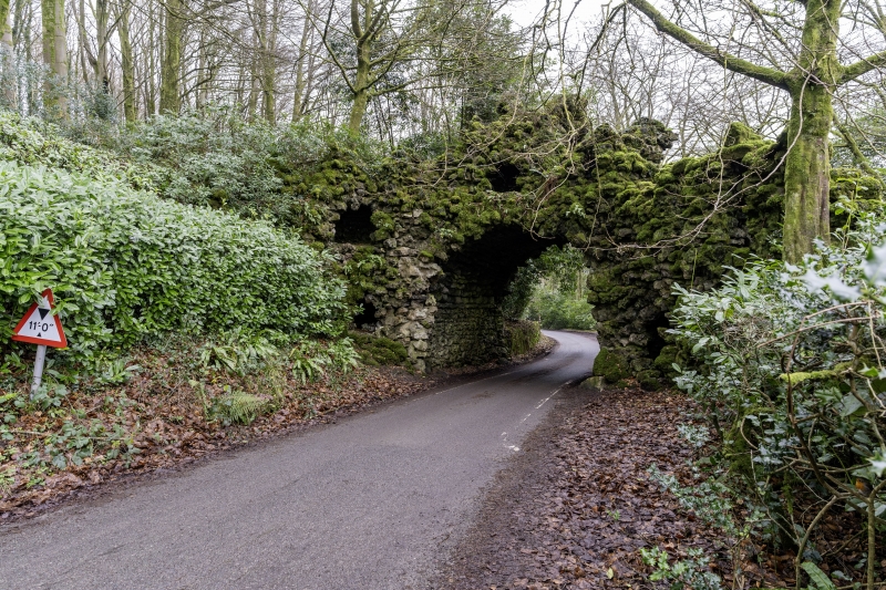
STOURTON WITH GASPER STOURHEAD GARDENS ST 73 SE (east side) 6/146 Rockwork Bridge 6.1.66 (formerly listed as The Rock Bridge) GV I Rustic bridge carrying track from lake to Temple of Apollo (q.v.) over the Zeals Road. 1762-65. Rustic limestone. Segmental-arched bridge with rough niches and revetment walls, track over is approached by steps lined with rockwork with several platforms with niches and 'windows', small rockwork bridge frames the path as it crosses the main bridge. The Hermitage built in 1771 and dismantled 1814 was incorporated into the picturesque approach to the rockwork bridge. (K. Woodbridge, The Stourhead Landscape, 1982)
Listing NGR: ST7726533837
External links are from the relevant listing authority and, where applicable, Wikidata. Wikidata IDs may be related buildings as well as this specific building. If you want to add or update a link, you will need to do so by editing the Wikidata entry.


Other nearby listed buildings