Latitude: 52.3587 / 52°21'31"N
Longitude: 0.8845 / 0°53'4"E
OS Eastings: 596519
OS Northings: 277318
OS Grid: TL965773
Mapcode National: GBR SGJ.2FQ
Mapcode Global: VHKCN.8ZZ6
Plus Code: 9F429V5M+FR
Entry Name: Old Hall
Listing Date: 14 July 1955
Grade: II
Source: Historic England
Source ID: 1198651
English Heritage Legacy ID: 284371
ID on this website: 101198651
Location: Barningham, West Suffolk, IP31
County: Suffolk
District: West Suffolk
Civil Parish: Barningham
Traditional County: Suffolk
Lieutenancy Area (Ceremonial County): Suffolk
Church of England Parish: Barningham St Andrew
Church of England Diocese: St.Edmundsbury and Ipswich
Tagged with: House
TN 97 NE BARNINGHAM THETFORD ROAD
1/18 Old Hall 14.7.55
- II
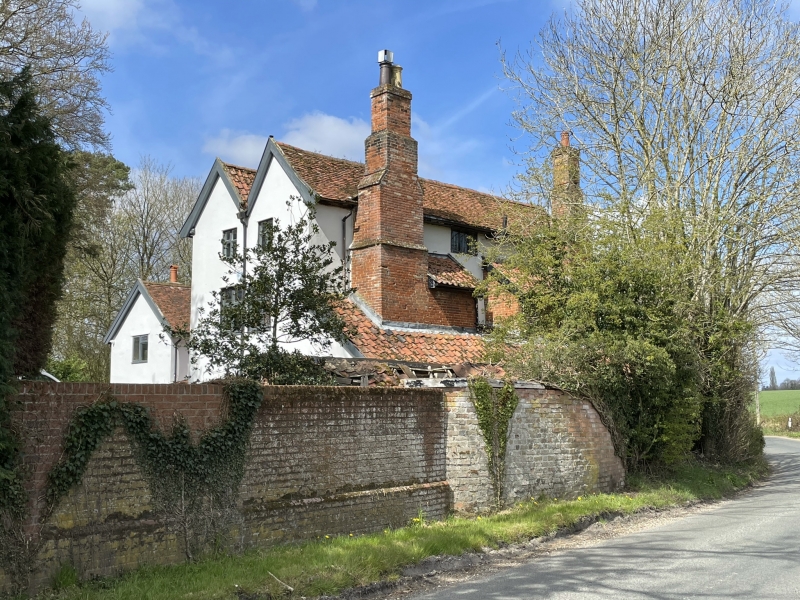
House. Early C17. 3 storeys. Timber-framed and rendered; 2-span roof, the western half plaintiled, the eastern with pantiles. 2 identical chimney- stacks are set externally on the east wall : Tudor brick; stepped sides, rebuilt shafts; possibly incorporating garderobes on the upper storey. A rendered and pantiled single-storey lean-to addition along the east side enclosing the bases of the chimney-stacks. Ovolo-moulded cross windows to both ground and first storeys; ovolo-moulded mull ioned windows to second storey. The interior retains some original panelling. A high-quality structure, possibly intended as a hunting-lodge. It is said to be a fragment of a much larger house built by the Barrow family, the last of whom, Maurice Barrow, died in 1666, but there is no structural evidence of this, and the present building seems complete in itself.
Listing NGR: TL9651977318
External links are from the relevant listing authority and, where applicable, Wikidata. Wikidata IDs may be related buildings as well as this specific building. If you want to add or update a link, you will need to do so by editing the Wikidata entry.


Other nearby listed buildings