Latitude: 52.5686 / 52°34'6"N
Longitude: 1.1105 / 1°6'37"E
OS Eastings: 610899
OS Northings: 301296
OS Grid: TG108012
Mapcode National: GBR TFF.ZJG
Mapcode Global: WHLSM.1P3Q
Plus Code: 9F43H496+C6
Entry Name: 65, Damgate Street
Listing Date: 29 December 1950
Grade: II
Source: Historic England
Source ID: 1196709
English Heritage Legacy ID: 386142
ID on this website: 101196709
Location: Wymondham, South Norfolk, NR18
County: Norfolk
District: South Norfolk
Civil Parish: Wymondham
Built-Up Area: Wymondham
Traditional County: Norfolk
Lieutenancy Area (Ceremonial County): Norfolk
Church of England Parish: Wymondham
Church of England Diocese: Norwich
Tagged with: Building
WYMONDHAM
TG1001 DAMGATE STREET 655-1/10/84 (East side) 29/12/50 No.65
II
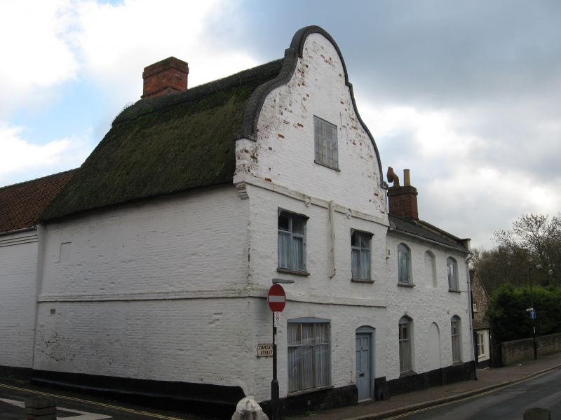
Formerly known as: Sun Inn DAMGATE STREET. House, formerly public house of some fame (The Sun Inn). North range C17, raised and with shaped gable added c. 1720. South extension added late C18, east extension late C19. Brick with flint. Early north range thatched, remainder pantiled. North range of 2 storeys and attic. West gable to street in 2 bays. Late C19 panelled door to right with a 3-light C18 transomed casement to its left. Platbands to each floor. 2 2-light transomed casements to first floor and a third in the shaped gable head. Gabled roof with ridge stack at east end. East gable straight. Late C18 extension to south of 2 storeys in 3 window bays, the centre bay blind to each floor. Two 2-light cross casements each floor under segmental heads. Gabled roof with south parapet. Datestone in south gable head nearly indecipherable at time of Review, but 179... visible (owner declares 1792, previous list 1795). Internal gable-end stack. C19 two-storey wing extends east from north range. Casements. INTERIOR. North range with chamfered bridging beam to ground floor and wide open fireplace in east wall. Winder staircase on east side of this. Roof replaced above astragal to stack, which has been raised.
Listing NGR: TG1089901296
External links are from the relevant listing authority and, where applicable, Wikidata. Wikidata IDs may be related buildings as well as this specific building. If you want to add or update a link, you will need to do so by editing the Wikidata entry.


Other nearby listed buildings