Latitude: 53.0755 / 53°4'31"N
Longitude: -0.8148 / 0°48'53"W
OS Eastings: 479495
OS Northings: 353802
OS Grid: SK794538
Mapcode National: GBR CLM.4T5
Mapcode Global: WHFHH.GY6L
Plus Code: 9C5X35GP+63
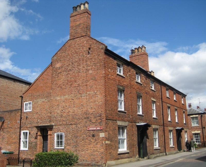
Entry Name: 16 A-16E, Millgate
Listing Date: 19 May 1971
Last Amended: 13 August 1992
Grade: II
Source: Historic England
Source ID: 1196435
English Heritage Legacy ID: 385116
ID on this website: 101196435
Location: Newark-on-Trent, Newark and Sherwood, Nottinghamshire, NG24
County: Nottinghamshire
District: Newark and Sherwood
Civil Parish: Newark
Built-Up Area: Newark-on-Trent
Traditional County: Nottinghamshire
Lieutenancy Area (Ceremonial County): Nottinghamshire
Church of England Parish: Newark-upon-Trent with Coddington
Church of England Diocese: Southwell and Nottingham
Tagged with: Building
NEWARK ON TRENT
SK7953NW MILLGATE 619-1/7/264 (North West side) 19/05/71 No.16 A-E (Formerly Listed as: NEWARK MILL LANE Nos.16 & 18)
GV II
House, now flats. Early C19, altered mid C19, converted to flats 1981. Brick with stone dressings and gabled and hipped slate roof. Plinth, first and second floor bands, splayed lintels, single side wall stack, slightly projecting right bay. 3 storeys; 3 window range of plain sashes and above, 3 smaller plain sashes. Below, central plain wooden doorcase flanked by Gothic arched scraper, with open pediment on scroll brackets. Fielded 6-panel door with overlight, flanked by single larger plain sashes. Right end has 2 plain sashes with segmental heads, that to left being a dummy. Above, a flat headed plain sash to left. Below, central doorcase with brick pilasters and flat hood, C20 6-panel door and overlight. On either side, a plain sash with segmental head, the right one larger.
Listing NGR: SK7949553802
External links are from the relevant listing authority and, where applicable, Wikidata. Wikidata IDs may be related buildings as well as this specific building. If you want to add or update a link, you will need to do so by editing the Wikidata entry.


Other nearby listed buildings