Latitude: 52.7998 / 52°47'59"N
Longitude: -2.1036 / 2°6'13"W
OS Eastings: 393108
OS Northings: 322475
OS Grid: SJ931224
Mapcode National: GBR 288.GZ1
Mapcode Global: WHBDT.NWGH
Plus Code: 9C4VQVXW+WG
Entry Name: St Leonard's School
Listing Date: 16 February 1994
Grade: II
Source: Historic England
Source ID: 1195364
English Heritage Legacy ID: 384032
ID on this website: 101195364
Location: Forebridge, Stafford, Staffordshire, ST17
County: Staffordshire
District: Stafford
Electoral Ward/Division: Forebridge
Parish: Non Civil Parish
Built-Up Area: Stafford
Traditional County: Staffordshire
Lieutenancy Area (Ceremonial County): Staffordshire
Church of England Parish: Stafford St Paul, Forebridge
Church of England Diocese: Lichfield
Tagged with: School building Girls' school
STAFFORD
SJ92SW ST LEONARD'S AVENUE 590-1/2/139 (North side) St Leonard's School
II
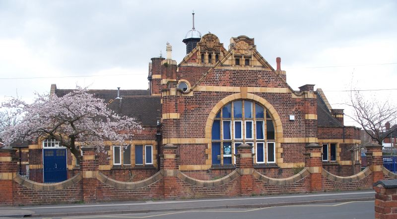
School. c1910-15. Red brick with terracotta dressings and plain tile roof with various end and side stacks. Arts and Crafts style. Single storey. Several picturesquely assembled blocks with main halls in centre and branching wings. Windows have terracotta mullions. Central gable has large round-arched window and decorative cresting. Lower wings to left and right and then similar gables, 2 to left and 1 to right, lead to turret porches, inscribed GIRLS to left and BOYS to right. Similar blocks and gable to rear. 2 fine roof lanterns with leaded ogee roofs. The school is a fine and imaginative composition.
Listing NGR: SJ9310822475
External links are from the relevant listing authority and, where applicable, Wikidata. Wikidata IDs may be related buildings as well as this specific building. If you want to add or update a link, you will need to do so by editing the Wikidata entry.


Other nearby listed buildings