Latitude: 52.8067 / 52°48'24"N
Longitude: -2.1183 / 2°7'5"W
OS Eastings: 392120
OS Northings: 323243
OS Grid: SJ921232
Mapcode National: GBR 16X.57V
Mapcode Global: WHBDT.FQH6
Plus Code: 9C4VRV4J+MM
Entry Name: 7, St Mary's Grove
Listing Date: 16 January 1951
Grade: II
Source: Historic England
Source ID: 1195327
English Heritage Legacy ID: 384040
ID on this website: 101195327
Location: Stafford, Staffordshire, ST16
County: Staffordshire
District: Stafford
Electoral Ward/Division: Forebridge
Parish: Non Civil Parish
Built-Up Area: Stafford
Traditional County: Staffordshire
Lieutenancy Area (Ceremonial County): Staffordshire
Church of England Parish: Stafford St Mary
Church of England Diocese: Lichfield
Tagged with: Building
STAFFORD
SJ9223SW ST MARY'S GROVE 590-1/10/89 (North side) 16/01/51 No.7
GV II
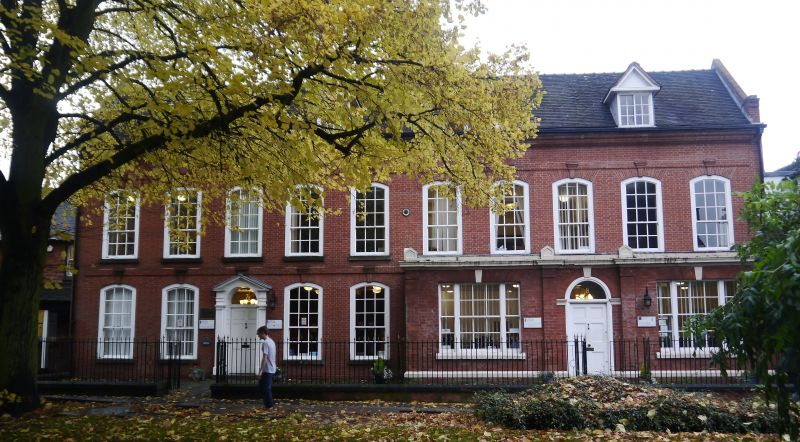
House, now office. Mid C18 with c1680 origins; restored c1985. Brick with timber-framed cross walls; double-span tile roof with coped gables and brick stack. Georgian style. EXTERIOR: 2 storeys with attic; symmetrical 5-window range. Brick platt band over ground floor; top brick frieze and cornice. Round-headed entrance has fluted pilasters and open pediment, fanlight over 6-panel door. Segmental-headed windows have rubbed brick cambered arches with brick keys over renewed 9/6-pane horned sashes. INTERIOR: remodelled, but retains C18 staircases, open strings, column on vase balusters and moulded handrails, panelled dados; late C17 oak panelling to ground floor; limestone-paved halls, with stairs approached through panelled arches with key blocks. Originally erected as a pair of semi-detached dwellings c1680, (see No.8 St Mary's Grove, qv), the front elevation was refaced c1740 (rebuilt c1985) and interior remodelled
Listing NGR: SJ9212023242
External links are from the relevant listing authority and, where applicable, Wikidata. Wikidata IDs may be related buildings as well as this specific building. If you want to add or update a link, you will need to do so by editing the Wikidata entry.


Other nearby listed buildings