Latitude: 51.5142 / 51°30'51"N
Longitude: -0.0977 / 0°5'51"W
OS Eastings: 532096
OS Northings: 181193
OS Grid: TQ320811
Mapcode National: GBR QC.6C
Mapcode Global: VHGR0.866J
Plus Code: 9C3XGW72+MW
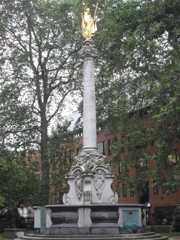
Entry Name: St Paul's Cross
Listing Date: 5 June 1972
Grade: II
Source: Historic England
Source ID: 1194637
English Heritage Legacy ID: 199742
ID on this website: 101194637
Location: St Paul's Cathedral, City of London, London, EC4M
County: London
District: City and County of the City of London
Electoral Ward/Division: Bread Street
Parish: Non Civil Parish
Built-Up Area: City of London
Traditional County: Middlesex
Lieutenancy Area (Ceremonial County): City of London
Church of England Parish: St Paul's Cathedral
Church of England Diocese: London
1. 5002 ST PAUL'S CHURCHYARD EC4
St Paul's Cross TQ 3281 SW 9/213 5.6.72.
II
2. 1910, by Sir R Blomfield and Sir B Mackennal. Doric column of Portland stone supporting bronze figure of St Paul. Elaborate base with 4 consoles and crouching figures of children. Enclosing stone wall with gate.
Listing NGR: TQ3209681193
External links are from the relevant listing authority and, where applicable, Wikidata. Wikidata IDs may be related buildings as well as this specific building. If you want to add or update a link, you will need to do so by editing the Wikidata entry.


Other nearby listed buildings