Latitude: 50.8419 / 50°50'30"N
Longitude: -0.7811 / 0°46'51"W
OS Eastings: 485920
OS Northings: 105414
OS Grid: SU859054
Mapcode National: GBR DGS.1CR
Mapcode Global: FRA 967W.5K3
Plus Code: 9C2XR6R9+QH
Entry Name: St Paul's Vicarage
Listing Date: 8 October 1971
Grade: II
Source: Historic England
Source ID: 1194469
English Heritage Legacy ID: 300133
ID on this website: 101194469
Location: Chichester, West Sussex, PO19
County: West Sussex
District: Chichester
Civil Parish: Chichester
Built-Up Area: Chichester
Traditional County: Sussex
Lieutenancy Area (Ceremonial County): West Sussex
Church of England Parish: Chichester St Paul
Church of England Diocese: Chichester
Tagged with: Clergy house
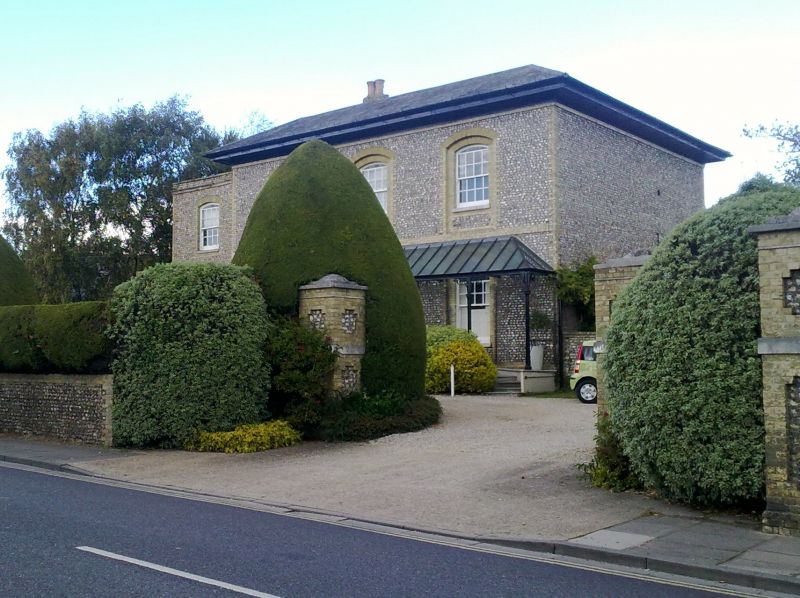
ST PAUL'S ROAD 1. 972 (North-East Side) SU 8505 SE 1/554 St Paul's Vicarage II 2. Mid C19. (not built as a Rectory) Flint with yellow brick quoins and dressings. 2 storeys. 3 windows. Sash windows in segmental arches in arcading; yellow brick dressings. Glazing bars intact in 1st floor windows; partly missing below. Panels of flint below windows. Yellow brick bands below first and ground floor windows. Round-headed doorway in centre; yellow brick dressings; semi- circular fanlight. Glass roofed veranda supported on iron columns projects in front of house from above ground floor windows.
Listing NGR: SU8592005414
External links are from the relevant listing authority and, where applicable, Wikidata. Wikidata IDs may be related buildings as well as this specific building. If you want to add or update a link, you will need to do so by editing the Wikidata entry.


Other nearby listed buildings