Latitude: 52.0462 / 52°2'46"N
Longitude: 0.9523 / 0°57'8"E
OS Eastings: 602545
OS Northings: 242763
OS Grid: TM025427
Mapcode National: GBR SL9.ML2
Mapcode Global: VHKF7.GT8Q
Plus Code: 9F422XW2+FW
Entry Name: 116, High Street
Listing Date: 26 April 1950
Grade: II
Source: Historic England
Source ID: 1194315
English Heritage Legacy ID: 277718
ID on this website: 101194315
Location: Hadleigh, Babergh, Suffolk, IP7
County: Suffolk
District: Babergh
Civil Parish: Hadleigh
Built-Up Area: Hadleigh
Traditional County: Suffolk
Lieutenancy Area (Ceremonial County): Suffolk
Church of England Parish: Hadleigh St Mary
Church of England Diocese: St.Edmundsbury and Ipswich
Tagged with: Building
l. 1161 HIGH STREET (North East Side) No 116 TM 0242 3/124 26.4.50.
II GV
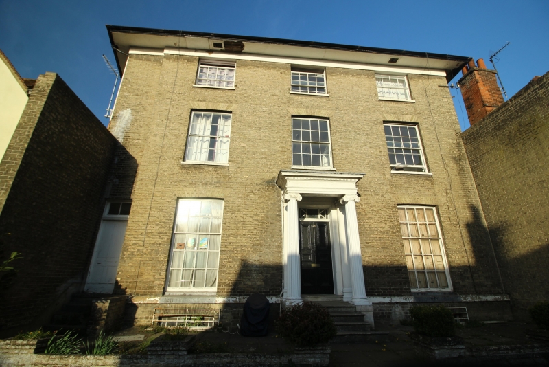
2. Early C19 Suffolk brick. 3 storeys and basement, roofs slate. Projecting eaves 3 window range, sash with glazing bars and flat arches. Central doorway, Ionic porch, 6-panel door, rectangular fanlight, Stands back a little from street. NMR photos.
Nos 96 to 130 (even) form a group.
Listing NGR: TM0254542763
External links are from the relevant listing authority and, where applicable, Wikidata. Wikidata IDs may be related buildings as well as this specific building. If you want to add or update a link, you will need to do so by editing the Wikidata entry.


Other nearby listed buildings