Latitude: 52.0432 / 52°2'35"N
Longitude: 0.9528 / 0°57'9"E
OS Eastings: 602593
OS Northings: 242421
OS Grid: TM025424
Mapcode National: GBR SL9.TZ6
Mapcode Global: VHKF7.GXJ3
Plus Code: 9F422XV3+74
Entry Name: Guildhall
Listing Date: 26 April 1950
Grade: I
Source: Historic England
Source ID: 1194046
English Heritage Legacy ID: 277636
ID on this website: 101194046
Location: Hadleigh, Babergh, Suffolk, IP7
County: Suffolk
District: Babergh
Civil Parish: Hadleigh
Built-Up Area: Hadleigh
Traditional County: Suffolk
Lieutenancy Area (Ceremonial County): Suffolk
Church of England Parish: Hadleigh St Mary
Church of England Diocese: St.Edmundsbury and Ipswich
Tagged with: City hall Seat of local government
1. 1161 CHURCH WALK Guildhall TM 0242 3/3 26.4.50.
I GV
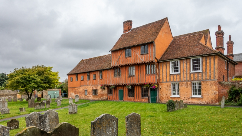
2. Latter part of Cl5 with later additions on east and west, a 3 storey wing on south-west and a long wing extending south. Frontage circa 80 ft. The whole building is timber-framed and plastered, roofs tiled. The timber-framing is exposed on the north side of the main building and this is the most interesting and picturesque part. Each of the upper storeys projects on this north front on curved brackets with moulded capitals and shafts - the shafts on ground floor front are panelled and have traceried heads. Some of the timberwork and most of the window mullions have been renewed, but the westerly window of the 1st floor has remains of traceried heads. Interior includes open kingpost roof and moulded beams. The wing on east originally projected (upper storey) on both sides but has been underbuilt in brick; the east end is semi-octagonal. The wing on west has mainly C18 characteristics and probably was part of the old Grammar School. The wing on south-west is of 3 storeys with projecting upper storey on south and the long wing extending south (used as a dormitory to the workhouse in C18) has ground floor brick facing on east with small panel and date 1780. NMR photos.
All the listed buildings in Church Walk form a group.
Listing NGR: TM0259342421
External links are from the relevant listing authority and, where applicable, Wikidata. Wikidata IDs may be related buildings as well as this specific building. If you want to add or update a link, you will need to do so by editing the Wikidata entry.


Other nearby listed buildings