Latitude: 53.4667 / 53°28'0"N
Longitude: -1.1405 / 1°8'25"W
OS Eastings: 457158
OS Northings: 397004
OS Grid: SK571970
Mapcode National: GBR NXGC.W0
Mapcode Global: WHDDG.G446
Plus Code: 9C5WFV85+MR
Entry Name: New Farm House
Listing Date: 5 June 1968
Last Amended: 26 November 1987
Grade: II
Source: Historic England
Source ID: 1193312
English Heritage Legacy ID: 334840
ID on this website: 101193312
Location: Wadworth, Doncaster, South Yorkshire, DN11
County: Doncaster
Civil Parish: Wadworth
Built-Up Area: Wadworth
Traditional County: Yorkshire
Lieutenancy Area (Ceremonial County): South Yorkshire
Church of England Parish: Wadworth with Loversall
Church of England Diocese: Sheffield
Tagged with: Farmhouse
WADWORTH CARR LANE SK59NE (north side)
5/66 New Farm House 5.6.68 (formerly listed as on Low Street)
II
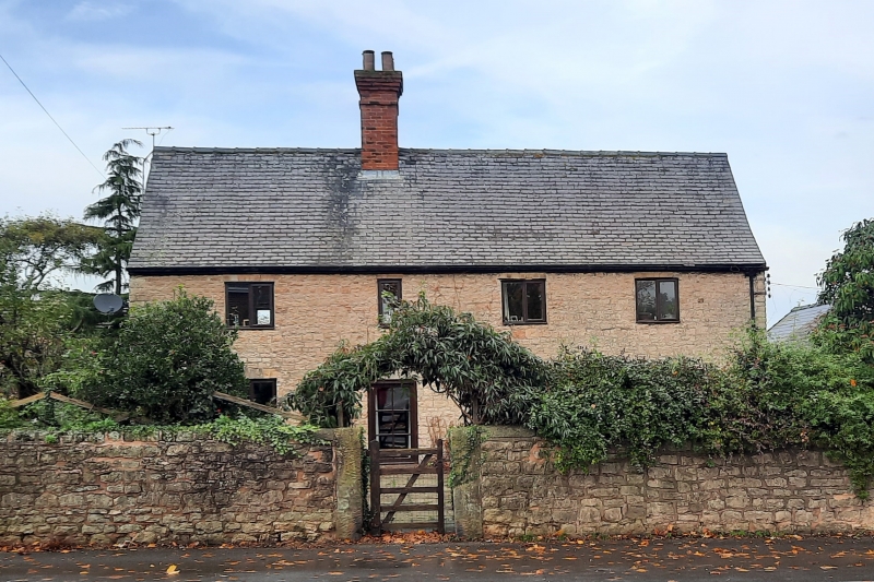
Farmhouse. Mid C18, altered. Rubble magnesian limestone, Welsh slate roof. 2 storeys, 4 windows to Ist floor; lower wing to rear right. Part-glazed door to left of centre beneath cemented arch flanked by C20 2-light casements with glazing bars with projecting sills and arches as door; matching casement on far right has flat arch. Ist floor: single-light casement over door flanked by casements as below with thin sills and flat arches; plain 2-light casement on far right. Later brick ridge stack above door. Shown as being on Low Street on O.S. map.
Listing NGR: SK5715897004
External links are from the relevant listing authority and, where applicable, Wikidata. Wikidata IDs may be related buildings as well as this specific building. If you want to add or update a link, you will need to do so by editing the Wikidata entry.


Other nearby listed buildings