Latitude: 51.4904 / 51°29'25"N
Longitude: -0.0339 / 0°2'1"W
OS Eastings: 536596
OS Northings: 178664
OS Grid: TQ365786
Mapcode National: GBR K5.VHP
Mapcode Global: VHGR1.CSFT
Plus Code: 9C3XFXR8+5C
Entry Name: Colonnade Building
Listing Date: 12 March 1973
Grade: II
Source: Historic England
Source ID: 1192450
English Heritage Legacy ID: 203299
ID on this website: 101192450
Location: Tavern Quay, Lewisham, London, SE8
County: London
District: Lewisham
Electoral Ward/Division: Evelyn
Parish: Non Civil Parish
Built-Up Area: Lewisham
Traditional County: Kent
Lieutenancy Area (Ceremonial County): Greater London
Church of England Parish: Deptford St Nicholas and St Luke
Church of England Diocese: Southwark
Tagged with: Building
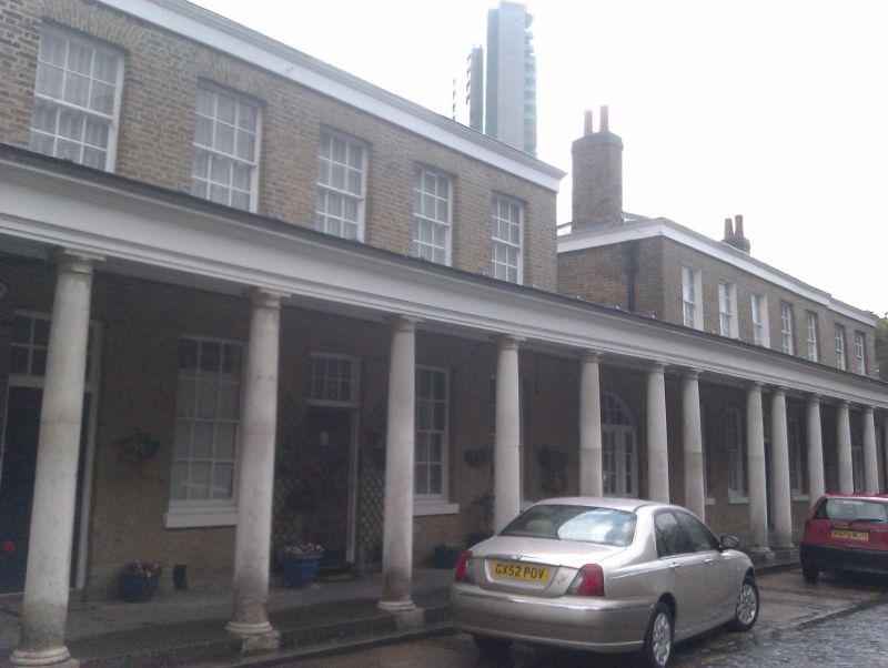
GROVE STREET SE8 1. 4424 (East Side) Royal Victoria Yard Colonnade Building TQ 3678 2/D20B II 2. Circa 1788. 2 blocks of 2 storeys 5 windows. multicoloured stock brick, low pitched hipped, slate roof. Gauged, near-flat brick arches to sash windows with glazing bars. Alternate 1st floor windows blocked. On ground floor buildings linked by Doric colonnade, of paired and single columns with entablature, extending beyond ends of buildings. 2 extra bays have been built at right above this extension. At left, centre and right, l-storey brick links have segment headed entrances with side lights and fanlights. 6-Panel doors, with rectangular fanlights, on axes. Now being converted to flat by Greater London Council.
Listing NGR: TQ3659678664
External links are from the relevant listing authority and, where applicable, Wikidata. Wikidata IDs may be related buildings as well as this specific building. If you want to add or update a link, you will need to do so by editing the Wikidata entry.


Other nearby listed buildings