Latitude: 53.4861 / 53°29'9"N
Longitude: -1.318 / 1°19'4"W
OS Eastings: 445348
OS Northings: 399034
OS Grid: SK453990
Mapcode National: GBR MX74.F2
Mapcode Global: WHDD5.QMKV
Plus Code: 9C5WFMPJ+CQ
Entry Name: Swinton Hall
Listing Date: 1 May 1974
Grade: II
Source: Historic England
Source ID: 1192422
English Heritage Legacy ID: 335539
ID on this website: 101192422
Location: Swinton, Rotherham, South Yorkshire, S64
County: Rotherham
Electoral Ward/Division: Swinton
Parish: Non Civil Parish
Built-Up Area: Wath upon Dearne
Traditional County: Yorkshire
Lieutenancy Area (Ceremonial County): South Yorkshire
Church of England Parish: Swinton St Margaret
Church of England Diocese: Sheffield
Tagged with: House
SK49NE SWINTON FITZWILLIAM STREET (east side)
6/30 Nos 1-8 (consec) (Swinton Hall) 1.5.74 GV II
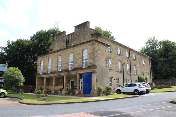
Large house now 8 dwellings. Late C18 or early C19, extensive C20 alterations. Coursed, dressed sandstone; C20 cement-tile roof. Rectangular, double-depth plan. 3 storeys with 2-storey addition to former garden front. 7-bay former entrance front. C20 casements with glazing bars throughout, tiles cemented onto projecting sills, plain lintels. Former entrance front: cemented plinth; projecting ashlar quoins; part-rendered ground floor. 3-bay central part has C20 door with overlight to left of 2 tall windows; 3 tall windows to 1st floor, central window with cornice. Outer bays have window to each of 3 floors. Set back to right the ashlar side wall of added loggia. Main range: cornice forms gutter; hipped roof to left; gable copings to right with truncated end stack. Right return: Doric loggia set to right of centre; tetrastyle in antis, set on raised pavement. Central doorway within loggia has plain, projecting surround and cornice (C20 glazed porch to right not of special interest). 1st floor: clasping pilaster strips flank 5 tall windows; cornice to flat roof. Above, set back, the twin gables of main range.
Listing NGR: SK4534899034
External links are from the relevant listing authority and, where applicable, Wikidata. Wikidata IDs may be related buildings as well as this specific building. If you want to add or update a link, you will need to do so by editing the Wikidata entry.


Other nearby listed buildings