Latitude: 54.0486 / 54°2'54"N
Longitude: -1.3136 / 1°18'48"W
OS Eastings: 445040
OS Northings: 461617
OS Grid: SE450616
Mapcode National: GBR MP8M.DG
Mapcode Global: WHD9G.SHPN
Plus Code: 9C6W2MXP+CH
Entry Name: Yeoman's Cottage
Listing Date: 12 December 1988
Grade: II
Source: Historic England
Source ID: 1190593
English Heritage Legacy ID: 331835
ID on this website: 101190593
Location: Great Ouseburn, North Yorkshire, YO26
County: North Yorkshire
District: Harrogate
Civil Parish: Great Ouseburn
Built-Up Area: Great Ouseburn
Traditional County: Yorkshire
Lieutenancy Area (Ceremonial County): North Yorkshire
Tagged with: Cottage
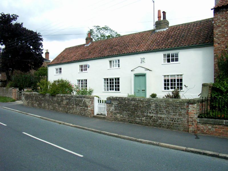
GREAT OUSEBURN MAIN STREET SE 4461-4561 north-east side) 9/20 Yeoman's Cottage GV II House. 1637 on datestone; C19 and C20 alteration and extension. Timber- framed, the front rendered; rear pink-brown brick in stretcher bond. Pantile roof and brick and rendered stacks. 3-cell, lobby-entry plan with continuous outshut; left bay an extension. 2-storey, 4-window front. Centre right panelled double doors in gabled projecting porch. Datestone over porch, carved in shallow relief, reads: Anno Dom .16 * 37. . R* *T . * Windows are small-pane, horizontal sliding sashes, 3-light on ground floor and 2-light on first floor. Centre right and left stacks, and right end external stack. Interior. Six braced posts from four pairs, raised on padstones, are visible. On ground floor, in room to left of entrance, original bressummer and plank door on cockshead hinges survive. Both rooms to left of entrance have massive chamfer-stopped spine beams, chamfered joists and stud partition wall. Studding survives in rear wall of left room. In right end room, C19 firegrate and breadoven, by Barker of Easingwold, inserted beneath chamfered bressummer. Plank door at rear. C19 closed string staircases in outshut with stick balusters, ramped-up handrail and tapered turned newels. At left end of outshut is original dairy, half sunk in ground. On first floor, wall studding survives between rooms to left of entrance.
Listing NGR: SE4504061617
External links are from the relevant listing authority and, where applicable, Wikidata. Wikidata IDs may be related buildings as well as this specific building. If you want to add or update a link, you will need to do so by editing the Wikidata entry.


Other nearby listed buildings