Latitude: 54.4868 / 54°29'12"N
Longitude: -1.1936 / 1°11'36"W
OS Eastings: 452341
OS Northings: 510465
OS Grid: NZ523104
Mapcode National: GBR NJ3K.DC
Mapcode Global: WHD7D.MHV5
Plus Code: 9C6WFRP4+PH
Entry Name: Tanton Farmhouse
Listing Date: 4 August 1983
Grade: II
Source: Historic England
Source ID: 1189335
English Heritage Legacy ID: 332014
ID on this website: 101189335
Location: Tanton, North Yorkshire, TS9
County: North Yorkshire
District: Hambleton
Civil Parish: Stokesley
Traditional County: Yorkshire
Lieutenancy Area (Ceremonial County): North Yorkshire
Church of England Parish: Stokesley with Seamer-in-Cleveland
Church of England Diocese: York
Tagged with: Farmhouse
NZ 51 SW STOKESLEY SOUTH TANTON 4/158
Tanton Farmhouse
II
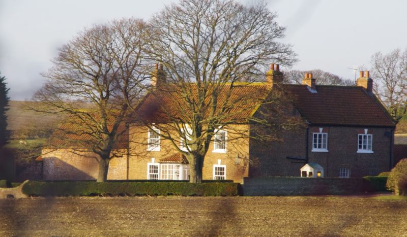
C18. Local red brick in English garden wall bond. Pantiled roofs with stone copings and kneelers, end chimneys, two rebuilt. L-shaped. Two storeys. Front range three bays rear wing two. Lower two-storey left extension of barn type. Gauged flat brick arches with keystones, and stone cills to windows, mostly replaced sashes with glazing bars though one original remains in rear wing, along with modern casements. Central door in modern glazed porch. Two Yorkshire sashes in the barn part, which has external stone stair behind and pigeon holes in gable.
Listing NGR: NZ5234110465
External links are from the relevant listing authority and, where applicable, Wikidata. Wikidata IDs may be related buildings as well as this specific building. If you want to add or update a link, you will need to do so by editing the Wikidata entry.


Other nearby listed buildings