Latitude: 54.446 / 54°26'45"N
Longitude: -1.1701 / 1°10'12"W
OS Eastings: 453914
OS Northings: 505935
OS Grid: NZ539059
Mapcode National: GBR NK81.G0
Mapcode Global: WHD7M.0J20
Plus Code: 9C6WCRWH+9X
Entry Name: School House
Listing Date: 23 June 1966
Grade: II
Source: Historic England
Source ID: 1189277
English Heritage Legacy ID: 333207
ID on this website: 101189277
Location: Kirkby, North Yorkshire, TS9
County: North Yorkshire
District: Hambleton
Civil Parish: Kirkby
Traditional County: Yorkshire
Lieutenancy Area (Ceremonial County): North Yorkshire
Church of England Parish: Kirkby-in-Cleveland St Augustine
Church of England Diocese: York
Tagged with: House
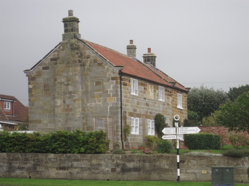
KIRKBY KIRKBY CROSSROADS NZ 50 NW 4/148 School House 23/6/66 II House, dated 1683 on lintel, but date recut. C17 appearance but considerably altered, and with later C18 right bay. Lightly-tooled coursed sandstone of almost ashlar quality, on chamfered plinth; similarly-tooled right bay but sandstone with much more iron content; upper courses of old part in this stone, showing eaves have been raised. Roof of concrete tiles with stone ridge, copings, kneelers and stacks. 2 storeys, 3 and 1 bays. Studded old door under flattened Tudor-arched lintel in right bay. Paired replaced sashes under inserted lintels at left. Yorkshire sashes in first-floor outer bays; filled panel between. In right bay a 3-light Yorkshire sash under extended keyed lintel. Copings and corniced stacks at ends and junction.
Interior not inspected but said to be much altered.
Pevsner, Yorkshire North Riding, p.214.
Listing NGR: NZ5391405935
External links are from the relevant listing authority and, where applicable, Wikidata. Wikidata IDs may be related buildings as well as this specific building. If you want to add or update a link, you will need to do so by editing the Wikidata entry.


Other nearby listed buildings