Latitude: 51.3709 / 51°22'15"N
Longitude: -0.0507 / 0°3'2"W
OS Eastings: 535780
OS Northings: 165336
OS Grid: TQ357653
Mapcode National: GBR JL.HVG
Mapcode Global: VHGRM.2SJZ
Plus Code: 9C3X9WCX+8P
Entry Name: Shirley Vicarage
Listing Date: 9 October 1981
Grade: II
Source: Historic England
Source ID: 1189029
English Heritage Legacy ID: 201246
ID on this website: 101189029
Location: Shirley, Croydon, London, CR0
County: London
District: Croydon
Electoral Ward/Division: Heathfield
Parish: Non Civil Parish
Built-Up Area: Croydon
Traditional County: Surrey
Lieutenancy Area (Ceremonial County): Greater London
Church of England Parish: Shirley St John
Church of England Diocese: Southwark
Tagged with: Clergy house
1. 5009 SHIRLEY CHURCH ROAD Shirley
Shirley Vicarage TQ 36 NE 3/4C 9.10.81
II
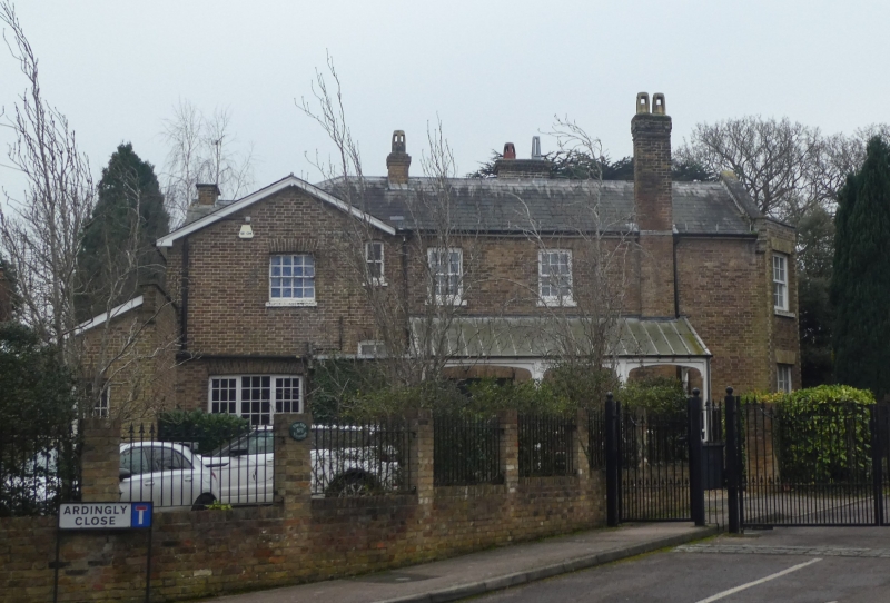
2. Circa 1840. Two storeys. Brown stock brick with shallow slated roofs and overhanging eaves. Shallow projecting bays on garden front and canted bay window on west elevation. Arched timber and glass verandahs. One time home of Rev William Wilks (1839-1923), Secretary of RHS, who developed the Shirley Poppy.
Listing NGR: TQ3578065336
External links are from the relevant listing authority and, where applicable, Wikidata. Wikidata IDs may be related buildings as well as this specific building. If you want to add or update a link, you will need to do so by editing the Wikidata entry.


Other nearby listed buildings