Latitude: 52.1868 / 52°11'12"N
Longitude: -1.709 / 1°42'32"W
OS Eastings: 419988
OS Northings: 254323
OS Grid: SP199543
Mapcode National: GBR 4LT.SWM
Mapcode Global: VHBY0.B9CF
Plus Code: 9C4W57PR+P9
Entry Name: Elmhurst
Listing Date: 9 February 1972
Grade: II
Source: Historic England
Source ID: 1187785
English Heritage Legacy ID: 366216
ID on this website: 101187785
Location: Old Town, Stratford-on-Avon, Warwickshire, CV37
County: Warwickshire
District: Stratford-on-Avon
Civil Parish: Stratford-upon-Avon
Built-Up Area: Stratford-upon-Avon
Traditional County: Warwickshire
Lieutenancy Area (Ceremonial County): Warwickshire
Church of England Parish: Stratford on Avon Holy Trinity
Church of England Diocese: Coventry
Tagged with: Building
STRATFORD-UPON-AVON
SP1954 COLLEGE LANE 604-1/5/61 (North side) 09/02/72 Elmhurst
GV II
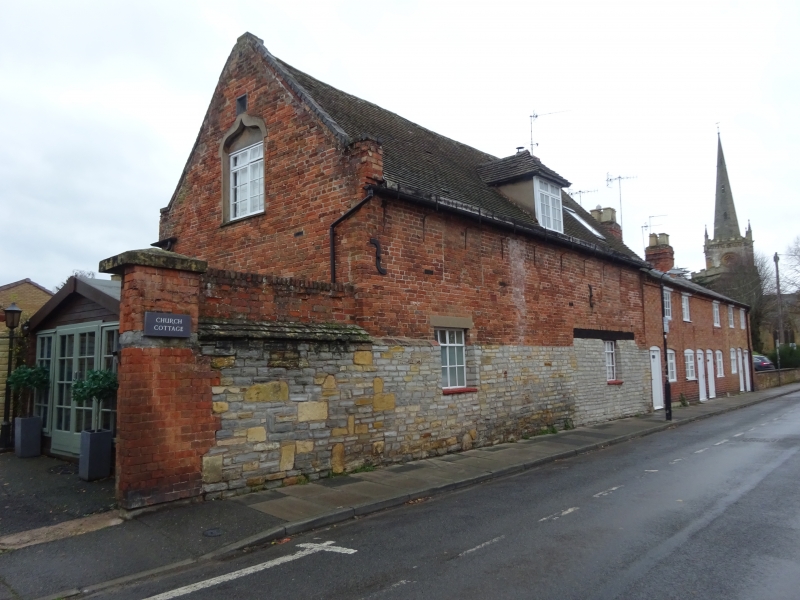
House. C17 or early C18. Brick with coursed squared limestone to ground floor of front; tile roof with coped left gable and right brick end stack. Single storey with attic; 2-window range. Windows to ground floor have C20 small-paned casements; 1st floor has signs of 2 blocked openings and a hipped dormer with small-paned cross-casement, skylight to right. Right end of ground floor has timber lintel over later stone infill indicating former cart entrance; stonework to left end has coping and is continued as garden wall in snecked stone with added brick courses. Left return has ogee-headed 1st-floor window with C20 small-paned casement under tympanum; gable originally with stone pinnacles, probably from the medieval college building on the site. Rear has later gabled timber porch and 2 dormers. The building is believed to have been an outbuilding to the College, used by the medieval priests of the collegiate church of Holy Trinity and demolished in 1799, the stone ground floor being part of the boundary wall. The surrounding area was developed in the early C19 as an area of good quality housing.
Listing NGR: SP1998854323
External links are from the relevant listing authority and, where applicable, Wikidata. Wikidata IDs may be related buildings as well as this specific building. If you want to add or update a link, you will need to do so by editing the Wikidata entry.


Other nearby listed buildings