Latitude: 54.5461 / 54°32'45"N
Longitude: -1.4732 / 1°28'23"W
OS Eastings: 434175
OS Northings: 516888
OS Grid: NZ341168
Mapcode National: GBR LH4W.V4
Mapcode Global: WHD6W.BZQR
Plus Code: 9C6WGGWG+CP
Entry Name: Thithe House
Listing Date: 10 December 1987
Grade: II
Source: Historic England
Source ID: 1185944
English Heritage Legacy ID: 350490
ID on this website: 101185944
Location: Sadberge, Darlington, County Durham, DL2
County: Darlington
Civil Parish: Sadberge
Built-Up Area: Sadberge
Traditional County: Durham
Lieutenancy Area (Ceremonial County): County Durham
Church of England Parish: Sadberge
Church of England Diocese: Durham
Tagged with: House
SADBERGE MIDDLETON ROAD NZ 3416 (West side)
15/114 Tithe House 10.12.87 II
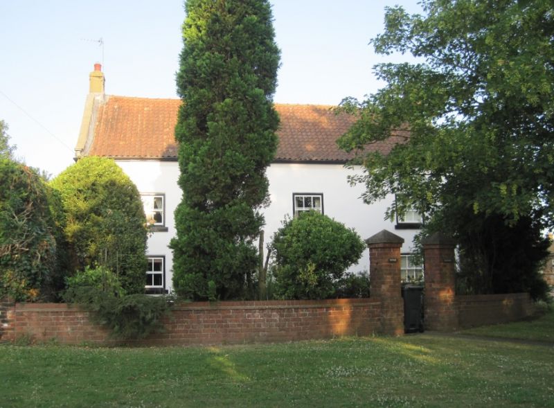
Former farmhouse, shown on OS map as Town Farm, now private house. Early and mid C18 of 2 builds: original section at left; C19 alterations and additions. Rendered and painted brick; renewed pantiled roof with rebuilt brick chimney stacks. 2 storeys, 3 widely-spaced bays. 4-panel door and overlight to left of centre. Replaced 6-pane sashes with projecting stone sills. Stepped eaves courses. Steeply-pitched roof has swept eaves and raised verges with corbelled-out kneelers. End and ridge stacks. Rear: scattered late C20 casements; added single-storey outshut under pent roof. Interior: ground-floor room at left has transverse ceiling beams of heavy scantling. C20 lean-to addition on left return is not of interest.
Listing NGR: NZ3417516888
External links are from the relevant listing authority and, where applicable, Wikidata. Wikidata IDs may be related buildings as well as this specific building. If you want to add or update a link, you will need to do so by editing the Wikidata entry.


Other nearby listed buildings