Latitude: 51.2427 / 51°14'33"N
Longitude: 0.6747 / 0°40'28"E
OS Eastings: 586789
OS Northings: 152680
OS Grid: TQ867526
Mapcode National: GBR QT4.3D6
Mapcode Global: VHJMP.N115
Plus Code: 9F326MVF+3V
Entry Name: 46-50, West Street
Listing Date: 14 December 1984
Grade: II
Source: Historic England
Source ID: 1185538
English Heritage Legacy ID: 173796
ID on this website: 101185538
Location: Harrietsham, Maidstone, Kent, ME17
County: Kent
District: Maidstone
Civil Parish: Harrietsham
Built-Up Area: Harrietsham
Traditional County: Kent
Lieutenancy Area (Ceremonial County): Kent
Tagged with: Building
HARRIETSHAM WEST STREET TQ 85 SE (north side)
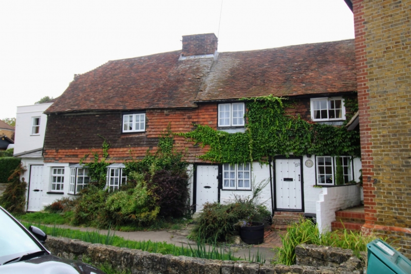
4/63 Nos. 46-50 (Even) GV Ii House row. Left section C17, right section early C19. Ground floor painted brick, first floor tile hung, with plain tile roof. In 2 sections of roughly equal length. Both sections 2 storeys, left on stone plinth, right on brick plinth. Roof of left section half hipped to left, roof of right at slightly shallower pitch. Red brick ridge stack to right end of left section. Small rendered stack to right end of right section, possibly part of no. 52. Irregular fenestration of 3 windows; one 2-light casement to left section, and one 2-light casement and one-horizontally sliding sash to right section. Ribbed door with rectangular light to No. 46 in small C19 left-end lean-to. Boarded-door to No. 48 to left end of right section and ribbed door with central glazed panel to No. 50 towards centre of right section. C19 rear wing to left of No. 46. Interior not inspected.
Listing NGR: TQ8678352683
External links are from the relevant listing authority and, where applicable, Wikidata. Wikidata IDs may be related buildings as well as this specific building. If you want to add or update a link, you will need to do so by editing the Wikidata entry.


Other nearby listed buildings