Latitude: 51.6398 / 51°38'23"N
Longitude: -1.6632 / 1°39'47"W
OS Eastings: 423403
OS Northings: 193501
OS Grid: SU234935
Mapcode National: GBR 5VZ.0BN
Mapcode Global: VHC0R.412Q
Plus Code: 9C3WJ8QP+WP
Entry Name: Coleshill Bridge
Listing Date: 20 September 1979
Grade: II
Source: Historic England
Source ID: 1184777
English Heritage Legacy ID: 318381
ID on this website: 101184777
Location: Coleshill, Swindon, Wiltshire, SN6
County: Oxfordshire
District: Vale of White Horse
Civil Parish: Highworth
Traditional County: Berkshire
Lieutenancy Area (Ceremonial County): Oxfordshire
Tagged with: Bridge
The asset was previously listed twice also under the parish of Coleshill at List entry 1182180. This entry was removed from the List on 6 May 2026.
This entry was subject to a Minor Amendment on 6 May 2026 using text in the de-listed entry and addition of river name, text “Early C19. Segmental” was changed to “River bridge over River Cole. Late C18 – early C19. Finely-jointed ashlar stone with a single span segmental”. The GIS triangle depiction was moved slightly from SU2340393501 to SU2340593503, thus placing it on the parish and district boundary between Coleshill, Vale of White Horse, Oxfordshire and Highworth, Swindon which passes through the building. The grid reference was removed from the Details text.
5410
HIGHWORTH
SU 29 SW 6/247
COLESHILL
Coleshill Bridge
II
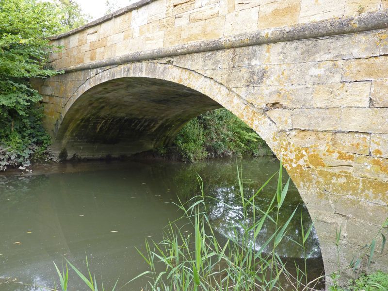
River bridge over River Cole. Late C18 – early C19. Finely-jointed ashlar stone with a single span segmental arch with moulded string over, parapet and cope. Parapet angled back to four cylindrical piers with moulded capping.
External links are from the relevant listing authority and, where applicable, Wikidata. Wikidata IDs may be related buildings as well as this specific building. If you want to add or update a link, you will need to do so by editing the Wikidata entry.


Other nearby listed buildings