Latitude: 52.2782 / 52°16'41"N
Longitude: -1.5968 / 1°35'48"W
OS Eastings: 427602
OS Northings: 264526
OS Grid: SP276645
Mapcode National: GBR 5M9.530
Mapcode Global: VHBXH.8ZNX
Plus Code: 9C4W7CH3+77
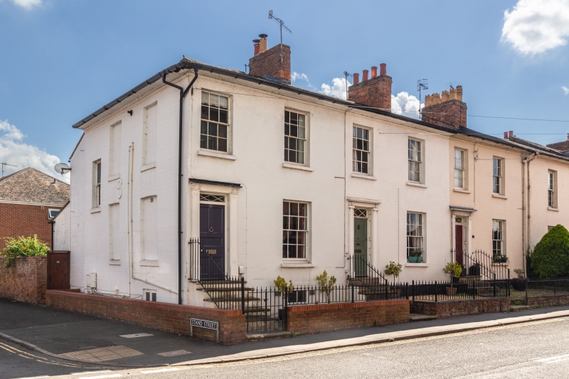
Entry Name: 21 22, Hampton Street
Listing Date: 19 March 1973
Grade: II
Source: Historic England
Source ID: 1184384
English Heritage Legacy ID: 307461
ID on this website: 101184384
Location: Warwick, Warwickshire, CV34
County: Warwickshire
District: Warwick
Civil Parish: Warwick
Built-Up Area: Warwick
Traditional County: Warwickshire
Lieutenancy Area (Ceremonial County): Warwickshire
Church of England Parish: Warwick St Paul
Church of England Diocese: Coventry
Tagged with: Building
1. 1781 HAMPTON STREET
Nos 21 and 22 SP 2764 8/449
II GV
2. 4 sashes in reveals glazing bars. 5 panel doors, oblong fanlights with geometrically patterned glazing bars. Doric pilasters with incised fret ornament, friezes, cornices. Nos 20 to 27 (consec), are a stucco terrace of the earlier C19 with low pitched Welsh slated hipped roof, wide cornice, basements and 2 storeys.
The terrace forms a group.
Listing NGR: SP2760264526
External links are from the relevant listing authority and, where applicable, Wikidata. Wikidata IDs may be related buildings as well as this specific building. If you want to add or update a link, you will need to do so by editing the Wikidata entry.


Other nearby listed buildings