Latitude: 51.4547 / 51°27'17"N
Longitude: -0.1627 / 0°9'45"W
OS Eastings: 527750
OS Northings: 174463
OS Grid: TQ277744
Mapcode National: GBR D7.5N6
Mapcode Global: VHGR5.4PBN
Plus Code: 9C3XFR3P+VW
Entry Name: Honeywell School
Listing Date: 7 April 1983
Grade: II
Source: Historic England
Source ID: 1184197
English Heritage Legacy ID: 207048
ID on this website: 101184197
Location: Wandsworth Common, Wandsworth, London, SW11
County: London
District: Wandsworth
Electoral Ward/Division: Northcote
Parish: Non Civil Parish
Built-Up Area: Wandsworth
Traditional County: Surrey
Lieutenancy Area (Ceremonial County): Greater London
Church of England Parish: Battersea St Michael, Wandsorth Common
Church of England Diocese: Southwark
Tagged with: School building
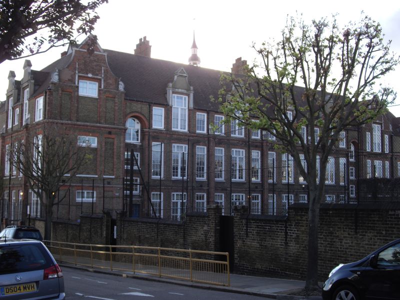
HONEYWELL ROAD SW11 1. 5033 Honeywell School TQ 27SE 4/10 II 2. 1891 by T J Bailey, Consultant Architect for the School Board for London. Yellow stocks with some red brick and with stone and fine red brick dressings and gauged arches. Lofty with Dutch gables. The north-east elevation has a 12-bay centre (2-storeys and attic) divided into 4 major bays by giant piers above each of which the cornice breaks forward and is crowned by an inverted console. Attic storey above cornice with the centre window of each major bay breaking through the eaves to form a gabled lucarne. On either side of this centre block, single bays with the windows set into a full height arched and deeply recessed niche. To the right, 2 further 3 windows wide gabled bays and to the left a single gabled bay with blind windows. The south-west elevation has a 5-bay centre divided by closely set piers. Bell turret and fleche above roof. Walls to playground.
Listing NGR: TQ2775074463
External links are from the relevant listing authority and, where applicable, Wikidata. Wikidata IDs may be related buildings as well as this specific building. If you want to add or update a link, you will need to do so by editing the Wikidata entry.


Other nearby listed buildings