Latitude: 51.3655 / 51°21'55"N
Longitude: -0.1529 / 0°9'10"W
OS Eastings: 528686
OS Northings: 164558
OS Grid: TQ286645
Mapcode National: GBR F7.N5C
Mapcode Global: VHGRK.9YJ2
Plus Code: 9C3X9R8W+6V
Entry Name: 36, Manor Road
Listing Date: 1 March 1974
Grade: II
Source: Historic England
Source ID: 1183683
English Heritage Legacy ID: 206758
ID on this website: 101183683
Location: Carshalton, Sutton, London, SM6
County: London
District: Sutton
Electoral Ward/Division: Wallington North
Parish: Non Civil Parish
Built-Up Area: Sutton
Traditional County: Surrey
Lieutenancy Area (Ceremonial County): Greater London
Church of England Parish: Wallington, Holy Trinity
Church of England Diocese: Southwark
Tagged with: Building
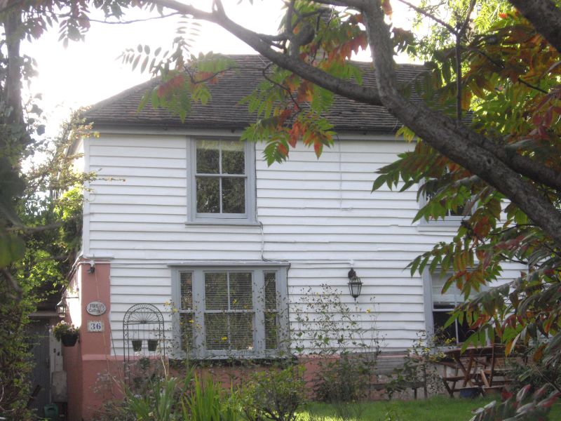
MANOR ROAD 1. 4430 (South-West Side) WALLINGTON No 36 TQ 2864 NE 22/111 II GV 2. C18 appearance; similar age to Nos 3 to 9 Wrights Row? 2 storeys. 2 window bays. Red plain tile M-shaped roof with hip to south. Weatherboard cladding to 1st floor, ground floor stuccoed. 2 sashes without glazing bars above; on ground floor, modern 3-light window to left hand and sash window without glazing bars to right hand. Entrance in south return.
The Duke's Head Public House, Stable Block, Nos 8 to 32 (even) and Nos 32 to 40 (even) form a group.
Listing NGR: TQ2868664558
External links are from the relevant listing authority and, where applicable, Wikidata. Wikidata IDs may be related buildings as well as this specific building. If you want to add or update a link, you will need to do so by editing the Wikidata entry.


Other nearby listed buildings