Latitude: 51.1932 / 51°11'35"N
Longitude: -1.9031 / 1°54'10"W
OS Eastings: 406870
OS Northings: 143784
OS Grid: SU068437
Mapcode National: GBR 3YD.5NF
Mapcode Global: VHB58.Y8SL
Plus Code: 9C3W53VW+7Q
Entry Name: Farnhurst
Listing Date: 4 July 1985
Grade: II
Source: Historic England
Source ID: 1181891
English Heritage Legacy ID: 319831
ID on this website: 101181891
Location: Shrewton, Wiltshire, SP3
County: Wiltshire
Civil Parish: Shrewton
Built-Up Area: Shrewton
Traditional County: Wiltshire
Lieutenancy Area (Ceremonial County): Wiltshire
Church of England Parish: Salisbury Plain
Church of England Diocese: Salisbury
Tagged with: Building
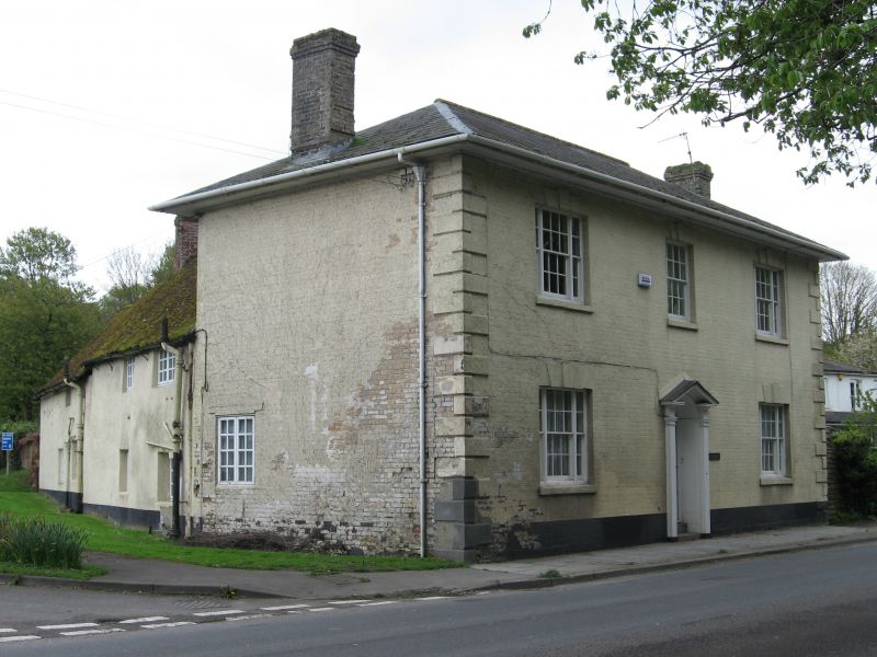
SHREWTON AMESBURY ROAD SU 04 SE (east side) 3/223 Farnhurst II Detached house. Early C18 cottages with early C19 front extension. Cob to rear with tiled roof, painted Flemish bond brick with Welsh slate hipped roof to front, brick stacks. L-plan. Symmetrical 2- storey, 3-window front. Central 6-panelled door with fanlight in round-arched opening, to either side is 12-pane tripartite sash with keystone. First floor has central 16-pane sash with tripartite sash either side. Chamfered rusticated quoins, deep eaves to hipped roof. Right return is windowless. Left return has one C20 2-light casement to ground floor. Rear range is former cob cottage with C20 casements. Interior not inspected.
Listing NGR: SU0687043784
External links are from the relevant listing authority and, where applicable, Wikidata. Wikidata IDs may be related buildings as well as this specific building. If you want to add or update a link, you will need to do so by editing the Wikidata entry.


Other nearby listed buildings