Latitude: 51.6407 / 51°38'26"N
Longitude: -1.2111 / 1°12'39"W
OS Eastings: 454688
OS Northings: 193833
OS Grid: SU546938
Mapcode National: GBR 90K.0N7
Mapcode Global: VHCYF.Y1L3
Plus Code: 9C3WJQRQ+7H
Entry Name: Street House
Listing Date: 4 November 1986
Grade: II
Source: Historic England
Source ID: 1181143
English Heritage Legacy ID: 248694
ID on this website: 101181143
Location: Long Wittenham, South Oxfordshire, OX14
County: Oxfordshire
District: South Oxfordshire
Civil Parish: Long Wittenham
Built-Up Area: Long Wittenham
Traditional County: Berkshire
Lieutenancy Area (Ceremonial County): Oxfordshire
Church of England Parish: Long Wittenham with Little Wittenham
Church of England Diocese: Oxford
Tagged with: House
LONG WITTENHAM HIGH STREET SU5493 (North side) 9/81 Street House
GV II
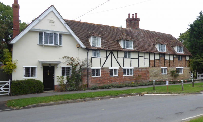
House. C17, early C20 addition to left. Coursed limestone rubble with red brick dressings to ground floor right; red brick to ground floor left of centre; red brick base with render, probably on brick,to left; large timber-framing with rendered infill to first floor left of centre; large timber-framing with herringbone pattern brick infill and some rendered upper panels to first floor right; old plain-tile roof, half-hipped to right; brick ridge stack to centre, end stack to left. 2 storeys and attic; 5-window range. 6-panel door to left with flat hood on brackets and flanking 2-light casements. Irregular fenestration of 2 or 3-light casements except wood bay on brackets to first floor left. 4 hipped dormers. Cross-gable to left. Timber-framing to right return and rear. Interior not inspected.
Listing NGR: SU5468893833
External links are from the relevant listing authority and, where applicable, Wikidata. Wikidata IDs may be related buildings as well as this specific building. If you want to add or update a link, you will need to do so by editing the Wikidata entry.


Other nearby listed buildings